Ereño
Ereño | |
|---|---|
 View of Ereño | |
 Seal | |
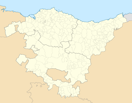 Ereño Location of Ereño within the Basque Country  Ereño Location of Ereño within Spain | |
| Coordinates: 43°21′04″N 2°36′57″W / 43.35111°N 2.61583°W | |
| Country | |
| Autonomous community | |
| Province | Biscay |
| Comarca | Busturialdea |
| Government | |
| • Mayor | Joseba Zarragoikoetxea Zenicacelaya |
| Area | |
| • Total | 10.67 km2 (4.12 sq mi) |
| Elevation | 278 m (912 ft) |
| Population (2018)[1] | |
| • Total | 239 |
| • Density | 22/km2 (58/sq mi) |
| Time zone | UTC+1 (CET) |
| • Summer (DST) | UTC+2 (CEST) |
| Postal code | 48313 |
| Website | www.ereno.org |
Ereño is a town and municipality located in the province of Biscay, in the autonomous community of the Basque Country, northern Spain.
Ereño is famous for its marble. In the 1st century CE the Romans were mining the quarries, which are no longer being used. There are literary references that call Ereño the "capital of the marble route". This material can be found in numerous buildings in Urdaibai and also on the other side of the ocean.
According to historian Tomás de Goikolea, Ereño was built in the 9th century and the residents of the town may be direct descendants of the inhabitants of the Santimamiñe cave.
On 29 September, the San Miguel festival, a popular mass is held and a pilgrimage is done.
References[edit]
www.ereno.org Archived 2008-09-08 at the Wayback Machine
- ^ Municipal Register of Spain 2018. National Statistics Institute.
External links[edit]

This article about a location in the Basque Country, Spain, is a stub. You can help Wikipedia by expanding it. |