Santee, Nebraska: Difference between revisions
Modified historical population template (via CenPop script) |
Red Director (talk | contribs) |
||
| (30 intermediate revisions by 21 users not shown) | |||
| Line 1: | Line 1: | ||
{{Use mdy dates|date=May 2024}} |
|||
{{Infobox settlement |
{{Infobox settlement |
||
|official_name = Santee, Nebraska |
|official_name = Santee, Nebraska |
||
| Line 21: | Line 22: | ||
<!-- Location --> |
<!-- Location --> |
||
|subdivision_type = [[List of sovereign states|Country]] |
|||
|coordinates_region = US-NE |
|||
| |
|subdivision_name = United States |
||
| |
|subdivision_type1 = [[U.S. state|State]] |
||
|subdivision_type1 = [[Political divisions of the United States|State]] |
|||
|subdivision_name1 = [[Nebraska]] |
|subdivision_name1 = [[Nebraska]] |
||
|subdivision_type2 = [[List of counties in Nebraska|County]] |
|subdivision_type2 = [[List of counties in Nebraska|County]] |
||
| Line 39: | Line 39: | ||
<!-- Area --> |
<!-- Area --> |
||
|unit_pref = Imperial |
|unit_pref = Imperial |
||
| ⚫ | |||
|area_footnotes = <ref name ="Gazetteer files"/> |
|||
|area_magnitude = |
|area_magnitude = |
||
|area_total_km2 = 1. |
|area_total_km2 = 1.46 |
||
|area_land_km2 = 1. |
|area_land_km2 = 1.46 |
||
|area_water_km2 = 0 |
|area_water_km2 = 0.00 |
||
|area_total_sq_mi = 0.56 |
|area_total_sq_mi = 0.56 |
||
|area_land_sq_mi = 0.56 |
|area_land_sq_mi = 0.56 |
||
|area_water_sq_mi = 0 |
|area_water_sq_mi = 0.00 |
||
<!-- Population --> |
<!-- Population --> |
||
|population_as_of = [[ |
|population_as_of = [[2020 United States Census|2020]] |
||
|population_est = |
|population_est = |
||
| ⚫ | |||
| ⚫ | |||
|population_footnotes = |
|population_footnotes = |
||
|population_total = |
|population_total = 424 |
||
|population_density_km2 = |
|population_density_km2 = 290.09 |
||
|population_density_sq_mi = |
|population_density_sq_mi = 751.77 |
||
<!-- General information --> |
<!-- General information --> |
||
| Line 62: | Line 62: | ||
|timezone_DST = CDT |
|timezone_DST = CDT |
||
|utc_offset_DST = -5 |
|utc_offset_DST = -5 |
||
|elevation_footnotes = |
|elevation_footnotes = <ref name=gnis/> |
||
| |
|elevation_ft = 1247 |
||
|coordinates = {{coord|42|50|19|N|97|50|58|W|region:US-NE|display=inline,title}} |
|||
|elevation_ft = 1243 |
|||
| ⚫ | |||
|coordinates_display = display=inline,title |
|||
| postal_code = 68760<ref>{{cite web|url=https://www.zipdatamaps.com/68760|title=Santee NE ZIP Code|publisher=zipdatamaps.com|year=2024|access-date=February 5, 2024}}</ref> |
|||
|latd = 42 |latm = 50 |lats = 19 |latNS = N |
|||
| area_code = [[Area codes 402 and 531|402 and 531]] |
|||
|longd = 97 |longm = 51 |longs = 11 |longEW = W |
|||
<!-- Area/postal codes & others --> |
|||
| ⚫ | |||
| ⚫ | |||
|area_code = |
|||
|blank_name = [[Federal Information Processing Standard|FIPS code]] |
|blank_name = [[Federal Information Processing Standard|FIPS code]] |
||
|blank_info = 31-43475<ref name="GR2">{{cite web|url= |
|blank_info = 31-43475<ref name="GR2">{{cite web|url=https://www.census.gov|publisher=[[United States Census Bureau]]|accessdate=January 31, 2008|title=U.S. Census website}}</ref> |
||
|blank1_name = [[Geographic Names Information System|GNIS]] feature ID |
|blank1_name = [[Geographic Names Information System|GNIS]] feature ID |
||
|blank1_info = |
|blank1_info = 2399182<ref name=gnis>{{GNIS|2399182}}</ref> |
||
|website = |
|website = |
||
|footnotes = |
|footnotes = |
||
|pop_est_footnotes = |
|||
}} |
}} |
||
'''Santee''' is the principal village of the [[Santee Sioux Reservation]] in [[Knox County, Nebraska|Knox County]], [[Nebraska]], |
'''Santee''' is the principal village of the [[Santee Sioux Reservation]] in [[Knox County, Nebraska|Knox County]], [[Nebraska]], United States. The population was 346 at the [[2010 United States Census|2010 census]].<ref>{{Cite web|url=http://www.yankton.net/articles/2011/03/03/community/doc4d6f181b374f9967268554.txt|title = Many Area Neb. Counties Lose Population}}</ref> |
||
==History== |
==History== |
||
The village was named for the [[Sioux Indians|Santee Sioux Indians]].<ref>{{cite web | url=http://www.epodunk.com/cgi-bin/genInfo.php?locIndex=27559 | title=Profile for Santee, NE | publisher=[[ePodunk]] | accessdate= |
The village was named for the [[Sioux Indians|Santee Sioux Indians]].<ref>{{cite web | url=http://www.epodunk.com/cgi-bin/genInfo.php?locIndex=27559 | title=Profile for Santee, NE | publisher=[[ePodunk]] | accessdate=August 18, 2014}}</ref> |
||
==Geography== |
==Geography== |
||
Santee is located at {{coord|42.838711|-97.853188|type:city_region:US|format=dms|display=inline}} (42.838711, -97.853188).<ref name="GR1">{{cite web|url=http://www.census.gov/geo/www/gazetteer/gazette.html|publisher=[[United States Census Bureau]]|accessdate=2011-04-23|date=2011-02-12|title=US Gazetteer files: 2010, 2000, and 1990}}</ref> |
|||
According to the [[United States Census Bureau]], the village has a total area of {{convert|0.56|sqmi|sqkm|2}}, all |
According to the [[United States Census Bureau]], the village has a total area of {{convert|0.56|sqmi|sqkm|2}}, all land.<ref name="Gazetteer files">{{cite web|title=US Gazetteer files 2010|url=https://www.census.gov/geo/www/gazetteer/files/Gaz_places_national.txt|publisher=[[United States Census Bureau]]|accessdate=June 24, 2012|url-status=dead|archiveurl=https://web.archive.org/web/20120125061959/http://www.census.gov/geo/www/gazetteer/files/Gaz_places_national.txt|archivedate=January 25, 2012}}</ref> |
||
==Demographics== |
==Demographics== |
||
| Line 96: | Line 91: | ||
|2000= 302 |
|2000= 302 |
||
|2010= 346 |
|2010= 346 |
||
|2020= 424 |
|||
|estyear=2015 |
|||
| ⚫ | |||
|estimate=344 |
|||
|estref=<ref name="USCensusEst2015">{{cite web|url=http://www.census.gov/popest/data/cities/totals/2015/SUB-EST2015.html|title=Annual Estimates of the Resident Population for Incorporated Places: April 1, 2010 to July 1, 2015|accessdate=July 2, 2016}}</ref> |
|||
| ⚫ | |||
}} |
}} |
||
===2010 census=== |
===2010 census=== |
||
As of the [[census]]<ref name =" |
As of the [[census]]<ref name ="wwwcensusgov">{{cite web|title=U.S. Census website|url=https://www.census.gov|publisher=[[United States Census Bureau]]|accessdate=June 24, 2012}}</ref> of 2010, there were 346 people, 100 households, and 80 families living in the village. The [[population density]] was {{convert|617.9|PD/sqmi|PD/km2|1}}. There were 117 housing units at an average density of {{convert|208.9|/sqmi|/km2|1}}. The racial makeup of the village was 2.9% [[White (U.S. Census)|White]], 92.5% [[Native American (U.S. Census)|Native American]], 0.3% from [[Race (U.S. Census)|other races]], and 4.3% from two or more races. [[Hispanic (U.S. Census)|Hispanic]] or [[Latino (U.S. Census)|Latino]] of any race were 7.5% of the population. |
||
There were 100 households of which 59.0% had children under the age of 18 living with them, 32.0% were [[Marriage|married couples]] living together, 35.0% had a female householder with no husband present, 13.0% had a male householder with no wife present, and 20.0% were non-families. 18.0% of all households were made up of individuals and 2% had someone living alone who was 65 years of age or older. The average household size was 3.46 and the average family size was 3.94. |
There were 100 households, of which 59.0% had children under the age of 18 living with them, 32.0% were [[Marriage|married couples]] living together, 35.0% had a female householder with no husband present, 13.0% had a male householder with no wife present, and 20.0% were non-families. 18.0% of all households were made up of individuals, and 2% had someone living alone who was 65 years of age or older. The average household size was 3.46 and the average family size was 3.94. |
||
The median age in the village was 21.8 years. 45.4% of residents were under the age of 18; 9.8% were between the ages of 18 and 24; 27.2% were from 25 to 44; 14.5% were from 45 to 64; and 3.2% were 65 years of age or older. The gender makeup of the village was 47.7% male and 52.3% female. |
The median age in the village was 21.8 years. 45.4% of residents were under the age of 18; 9.8% were between the ages of 18 and 24; 27.2% were from 25 to 44; 14.5% were from 45 to 64; and 3.2% were 65 years of age or older. The gender makeup of the village was 47.7% male and 52.3% female. |
||
===2000 census=== |
===2000 census=== |
||
As of the [[census]]<ref name="GR2" /> of 2000, there were 302 people, 98 households, and 64 families |
As of the [[census]]<ref name="GR2" /> of 2000, there were 302 people, 98 households, and 64 families living in the village. The population density was {{convert|536.4|PD/sqmi|PD/km2|sp=us|adj=off}}. There were 116 housing units at an average density of {{convert|206.0|/sqmi|/km2|sp=us|adj=off}}. The racial makeup of the village was 7.28% [[White (U.S. Census)|White]], 89.07% [[Native American (U.S. Census)|Native American]], 1.66% from [[Race (United States Census)|other races]], and 1.99% from two or more races. [[Hispanic (U.S. Census)|Hispanic]] or [[Latino (U.S. Census)|Latino]] of any race were 0.99% of the population. |
||
There were 98 households out of which 42.9% had children under the age of 18 living with them, 20.4% were [[Marriage|married couples]] living together, 35.7% had a female householder with no husband present, and 33.7% were non-families. 25.5% of all households were made up of individuals and 7.1% had someone living alone who was 65 years of age or older. The average household size was 3.08 and the average family size was 3.71. |
There were 98 households, out of which 42.9% had children under the age of 18 living with them, 20.4% were [[Marriage|married couples]] living together, 35.7% had a female householder with no husband present, and 33.7% were non-families. 25.5% of all households were made up of individuals, and 7.1% had someone living alone who was 65 years of age or older. The average household size was 3.08 and the average family size was 3.71. |
||
In the village the population was spread out with 45.0% under the age of 18, 11.6% from 18 to 24, 25.2% from 25 to 44, 13.2% from 45 to 64, and 5.0% who were 65 years of age or older. The median age was 21 years. For every 100 females there were 81.9 males. For every 100 females age 18 and over, there were 80.4 males. |
In the village, the population was spread out, with 45.0% under the age of 18, 11.6% from 18 to 24, 25.2% from 25 to 44, 13.2% from 45 to 64, and 5.0% who were 65 years of age or older. The median age was 21 years. For every 100 females, there were 81.9 males. For every 100 females age 18 and over, there were 80.4 males. |
||
As of 2000 the median income for a household in the village was $16,250, and the median income for a family was $17,813. Males had a median income of $21,875 versus $21,875 for females. The [[per capita income]] for the village was $7,879. About 47.5% of families and 45.4% of the population were below the [[poverty line]], including 44.5% of those under the age of eighteen and 53.8% of those |
As of 2000 the median income for a household in the village was $16,250, and the median income for a family was $17,813. Males had a median income of $21,875 versus $21,875 for females. The [[per capita income]] for the village was $7,879. About 47.5% of families and 45.4% of the population were below the [[poverty line]], including 44.5% of those under the age of eighteen and 53.8% of those 65 or over. |
||
==References== |
==References== |
||
| Line 122: | Line 115: | ||
{{Knox County, Nebraska}} |
{{Knox County, Nebraska}} |
||
{{authority control}} |
|||
[[Category:Villages in Knox County, Nebraska]] |
[[Category:Villages in Knox County, Nebraska]] |
||
Latest revision as of 22:10, 14 May 2024
Santee, Nebraska | |
|---|---|
 Santee, seen from the cemetery hill south of town | |
 Location of Santee, Nebraska | |
| Coordinates: 42°50′19″N 97°50′58″W / 42.83861°N 97.84944°W | |
| Country | United States |
| State | Nebraska |
| County | Knox |
| Area | |
| • Total | 0.56 sq mi (1.46 km2) |
| • Land | 0.56 sq mi (1.46 km2) |
| • Water | 0.00 sq mi (0.00 km2) |
| Elevation | 1,247 ft (380 m) |
| Population (2020) | |
| • Total | 424 |
| • Density | 751.77/sq mi (290.09/km2) |
| Time zone | UTC-6 (Central (CST)) |
| • Summer (DST) | UTC-5 (CDT) |
| ZIP code | 68760[3] |
| Area code(s) | 402 and 531 |
| FIPS code | 31-43475[4] |
| GNIS feature ID | 2399182[2] |
Santee is the principal village of the Santee Sioux Reservation in Knox County, Nebraska, United States. The population was 346 at the 2010 census.[5]
History
[edit]The village was named for the Santee Sioux Indians.[6]
Geography
[edit]According to the United States Census Bureau, the village has a total area of 0.56 square miles (1.45 km2), all land.[7]
Demographics
[edit]| Census | Pop. | Note | %± |
|---|---|---|---|
| 1980 | 388 | — | |
| 1990 | 365 | −5.9% | |
| 2000 | 302 | −17.3% | |
| 2010 | 346 | 14.6% | |
| 2020 | 424 | 22.5% | |
| U.S. Decennial Census[8] | |||
2010 census
[edit]As of the census[9] of 2010, there were 346 people, 100 households, and 80 families living in the village. The population density was 617.9 inhabitants per square mile (238.6/km2). There were 117 housing units at an average density of 208.9 per square mile (80.7/km2). The racial makeup of the village was 2.9% White, 92.5% Native American, 0.3% from other races, and 4.3% from two or more races. Hispanic or Latino of any race were 7.5% of the population.
There were 100 households, of which 59.0% had children under the age of 18 living with them, 32.0% were married couples living together, 35.0% had a female householder with no husband present, 13.0% had a male householder with no wife present, and 20.0% were non-families. 18.0% of all households were made up of individuals, and 2% had someone living alone who was 65 years of age or older. The average household size was 3.46 and the average family size was 3.94.
The median age in the village was 21.8 years. 45.4% of residents were under the age of 18; 9.8% were between the ages of 18 and 24; 27.2% were from 25 to 44; 14.5% were from 45 to 64; and 3.2% were 65 years of age or older. The gender makeup of the village was 47.7% male and 52.3% female.
2000 census
[edit]As of the census[4] of 2000, there were 302 people, 98 households, and 64 families living in the village. The population density was 536.4 inhabitants per square mile (207.1/km2). There were 116 housing units at an average density of 206.0 per square mile (79.5/km2). The racial makeup of the village was 7.28% White, 89.07% Native American, 1.66% from other races, and 1.99% from two or more races. Hispanic or Latino of any race were 0.99% of the population.
There were 98 households, out of which 42.9% had children under the age of 18 living with them, 20.4% were married couples living together, 35.7% had a female householder with no husband present, and 33.7% were non-families. 25.5% of all households were made up of individuals, and 7.1% had someone living alone who was 65 years of age or older. The average household size was 3.08 and the average family size was 3.71.
In the village, the population was spread out, with 45.0% under the age of 18, 11.6% from 18 to 24, 25.2% from 25 to 44, 13.2% from 45 to 64, and 5.0% who were 65 years of age or older. The median age was 21 years. For every 100 females, there were 81.9 males. For every 100 females age 18 and over, there were 80.4 males.
As of 2000 the median income for a household in the village was $16,250, and the median income for a family was $17,813. Males had a median income of $21,875 versus $21,875 for females. The per capita income for the village was $7,879. About 47.5% of families and 45.4% of the population were below the poverty line, including 44.5% of those under the age of eighteen and 53.8% of those 65 or over.
References
[edit]- ^ "ArcGIS REST Services Directory". United States Census Bureau. Retrieved September 18, 2022.
- ^ a b U.S. Geological Survey Geographic Names Information System: Santee, Nebraska
- ^ "Santee NE ZIP Code". zipdatamaps.com. 2024. Retrieved February 5, 2024.
- ^ a b "U.S. Census website". United States Census Bureau. Retrieved January 31, 2008.
- ^ "Many Area Neb. Counties Lose Population".
- ^ "Profile for Santee, NE". ePodunk. Retrieved August 18, 2014.
- ^ "US Gazetteer files 2010". United States Census Bureau. Archived from the original on January 25, 2012. Retrieved June 24, 2012.
- ^ "Census of Population and Housing". Census.gov. Retrieved June 4, 2015.
- ^ "U.S. Census website". United States Census Bureau. Retrieved June 24, 2012.
Municipalities and communities of Knox County, Nebraska, United States | ||
|---|---|---|
| Cities | 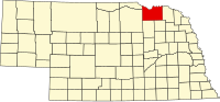 | |
| Villages | ||
| Townships | ||
| CDP | ||
| Unincorporated communities | ||
| Indian reservations | ||
| International | |
|---|---|
| National | |