Category:Appalachian Development Highway System
Jump to navigation
Jump to search
highway development system | |||||
| Upload media | |||||
| Instance of |
| ||||
|---|---|---|---|---|---|
| Named after | |||||
| Location |
| ||||
| |||||
Media in category "Appalachian Development Highway System"
The following 16 files are in this category, out of 16 total.
-
1228039.jpg 547 × 394; 69 KB
-
1966 map of the Appalachian Development Highway System.jpg 7,136 × 8,464; 12.25 MB
-
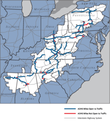
ADHS 2016-09-30.png 1,567 × 1,736; 147 KB
-
ADHS September 30, 2004.png 581 × 559; 68 KB
-
ADHS September 30, 2005.png 584 × 550; 61 KB
-
ADHSMap.png 1,547 × 1,703; 139 KB
-
Appalachian Corridor S, Grainger County, TN.jpg 4,032 × 2,688; 2.85 MB
-
Construction on US 25E at SR 160, 1976.jpg 1,644 × 1,138; 760 KB
-
Corridor G north of Logan.jpg 413 × 550; 73 KB
-
Corridor Q western terminus.jpg 550 × 396; 60 KB
-
Corridor V US 72.JPG 1,536 × 2,048; 589 KB
-
Corridor X shields along future Interstate 22 in Alabama.jpg 550 × 805; 127 KB
-
Cumberland Gap Tunnel Construction in 1993-1996.png 1,177 × 818; 1.2 MB
-
Hatfield McCoy Trail System.jpg 404 × 600; 56 KB
-
US19-US74-US129-Murphy.jpg 5,520 × 3,684; 6.67 MB
-
US64 Gantry-Franklin NC.jpg 5,520 × 3,105; 5.69 MB