Rockaway Beach, Queens: Difference between revisions
m Bot: link syntax |
Wikiuser17 (talk | contribs) Tags: Mobile edit Mobile web edit Advanced mobile edit |
||
| (29 intermediate revisions by 22 users not shown) | |||
| Line 27: | Line 27: | ||
| subdivision_name3 = {{Flagicon image|Flag of Queens County, New York.svg}} [[Queens]] |
| subdivision_name3 = {{Flagicon image|Flag of Queens County, New York.svg}} [[Queens]] |
||
| subdivision_type4 = [[Community boards of Queens|Community District]] |
| subdivision_type4 = [[Community boards of Queens|Community District]] |
||
| subdivision_name4 = [[Queens Community Board 14|Queens 14]]<ref name="NYCPlanning">{{cite web |
| subdivision_name4 = [[Queens Community Board 14|Queens 14]]<ref name="NYCPlanning">{{cite web|title=NYC Planning {{!}} Community Profiles|url=https://communityprofiles.planning.nyc.gov/queens/14|website=communityprofiles.planning.nyc.gov|publisher=New York City Department of City Planning|access-date=April 7, 2018|archive-date=June 22, 2019|archive-url=https://web.archive.org/web/20190622142759/https://communityprofiles.planning.nyc.gov/queens/14|url-status=live}}</ref> |
||
<!-- established ---------------> |
<!-- established ---------------> |
||
| Line 72: | Line 72: | ||
| utc_offset_DST = −4 |
| utc_offset_DST = −4 |
||
| postal_code_type = [[ZIP Code]] |
| postal_code_type = [[ZIP Code]] |
||
| postal_code = |
| postal_code = 11693 |
||
| area_code_type = [[Telephone numbering plan|Area code]]s |
| area_code_type = [[Telephone numbering plan|Area code]]s |
||
| area_code = [[Area codes 718, 347, and 929|718, 347, 929]], and [[Area code 917|917]] |
| area_code = [[Area codes 718, 347, and 929|718, 347, 929]], and [[Area code 917|917]] |
||
| Line 82: | Line 82: | ||
===Early development=== |
===Early development=== |
||
[[File:History of Queens County, New York, with illustrations, portraits, and sketches of prominent families and individuals (1882) (14789338523).jpg|thumb|left|upright=1.2|Rockaway Beach in the 1880s, with new railroad and resort hotel]] |
[[File:History of Queens County, New York, with illustrations, portraits, and sketches of prominent families and individuals (1882) (14789338523).jpg|thumb|left|upright=1.2|Rockaway Beach in the 1880s, with new railroad and resort hotel]] |
||
What is now Rockaway Beach was formerly two different hamlets, Holland and [[Hammels, Queens|Hammels]]. In 1857, Michael P. Holland had purchased land and named the area after himself. Soon afterward, Louis Hammel, an immigrant from [[Germany]], bought a tract of land just east of Holland. In 1878, he decided to give portions of his land to the [[New York, Woodhaven and Rockaway Railroad]] in order to build a railroad station for the peninsula. The area around it became collectively known as "Hammels". On June 11, 1897, Hammels merged with Holland and they incorporated as the Village of Rockaway Beach.<ref>{{cite book|author=New York (State). Legislature. Senate|title=Documents of the Senate of the State of New York|url=https://books.google.com/books?id=nqslAQAAIAAJ&pg=PR9|page=9|language=en|date=January 1, 1913|access-date=July 24, 2016}}</ref> One year later, it was incorporated into the [[City of Greater New York]] and became part of the newly formed borough of [[Queens]]. However, the neighborhood, along with the eastern communities of [[Arverne, Queens|Arverne]] and [[Far Rockaway, Queens|Far Rockaway]], tried to secede from the city several times. In 1915 and 1917, a bill approving the secession passed in the legislature but was vetoed by the mayor at the time, [[John Purroy Mitchel]].<ref>{{cite web | |
What is now Rockaway Beach was formerly two different hamlets, Holland and [[Hammels, Queens|Hammels]]. In 1857, Michael P. Holland had purchased land and named the area after himself. Soon afterward, Louis Hammel, an immigrant from [[Germany]], bought a tract of land just east of Holland. In 1878, he decided to give portions of his land to the [[New York, Woodhaven and Rockaway Railroad]] in order to build a railroad station for the peninsula. The area around it became collectively known as "Hammels". On June 11, 1897, Hammels merged with Holland and they incorporated as the Village of Rockaway Beach.<ref>{{cite book|author=New York (State). Legislature. Senate|title=Documents of the Senate of the State of New York|url=https://books.google.com/books?id=nqslAQAAIAAJ&pg=PR9|page=9|language=en|date=January 1, 1913|access-date=July 24, 2016}}</ref> One year later, it was incorporated into the [[City of Greater New York]] and became part of the newly formed borough of [[Queens]]. However, the neighborhood, along with the eastern communities of [[Arverne, Queens|Arverne]] and [[Far Rockaway, Queens|Far Rockaway]], tried to secede from the city several times. In 1915 and 1917, a bill approving the secession passed in the legislature but was vetoed by the mayor at the time, [[John Purroy Mitchel]].<ref>{{cite web |website=Rootsweb.com |url=http://www.rootsweb.com/~nynassa2/rockaways.htm |title=The Rockaways |access-date=December 6, 2006 |archive-date=January 10, 2007 |archive-url=https://web.archive.org/web/20070110003136/http://www.rootsweb.com/~nynassa2/rockaways.htm |url-status=live }}</ref> |
||
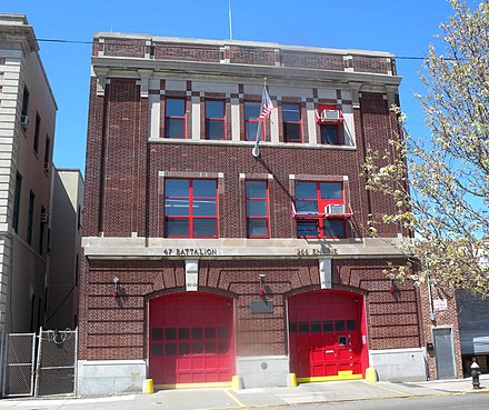
[[File:NYPD B94 jeh.jpg|thumb|right|Police station]] |
[[File:NYPD B94 jeh.jpg|thumb|right|Police station]] |
||
| Line 90: | Line 90: | ||
Rockaway's famous amusement park, [[Rockaways' Playland]], was built in 1901 and quickly became a major attraction for people around the region. With its growing popularity, concern over swimming etiquette became a problem and early in 1904, the Captain of the [[NYPD]], Louis Kreuscher, issued rules for those using the beach, censoring the bathing suits to be worn, where photographs could be taken, and specifying that women in bathing suits were not allowed to leave the beachfront.<ref>{{cite news |journal=[[New York Times]] |date=May 16, 1904 |page=9 |title=A Summer Girl Edit}}</ref> |
Rockaway's famous amusement park, [[Rockaways' Playland]], was built in 1901 and quickly became a major attraction for people around the region. With its growing popularity, concern over swimming etiquette became a problem and early in 1904, the Captain of the [[NYPD]], Louis Kreuscher, issued rules for those using the beach, censoring the bathing suits to be worn, where photographs could be taken, and specifying that women in bathing suits were not allowed to leave the beachfront.<ref>{{cite news |journal=[[New York Times]] |date=May 16, 1904 |page=9 |title=A Summer Girl Edit}}</ref> |
||
The park was grand for its time. One of its most popular attractions, the Atom Smasher roller coaster, would be featured in the beginning of ''[[This is Cinerama]]'', a pre-[[IMAX]] type movie, in 1952.<ref>{{cite news |url=http://themeparks.about.com/b/a/249690.htm |title=Theme Parks | |
The park was grand for its time. One of its most popular attractions, the Atom Smasher roller coaster, would be featured in the beginning of ''[[This is Cinerama]]'', a pre-[[IMAX]] type movie, in 1952.<ref>{{cite news |url=http://themeparks.about.com/b/a/249690.htm |title=Theme Parks |website=About.com |access-date=December 7, 2006 |archive-date=March 19, 2006 |archive-url=https://web.archive.org/web/20060319160800/http://themeparks.about.com/b/a/249690.htm |url-status=live }}</ref> An [[Olympic-size swimming pool]] and a million-dollar midway also were built within the amusement park; they would serve the community for over eighty years.<ref>{{cite news |url=http://www.rockawave.com/common/history/history.html |title=Rockaway...'place of waters bright' |journal=[[Wave of Long Island|The Wave]] |access-date=December 6, 2006 |url-status=dead |archive-url=https://web.archive.org/web/20061127222828/http://www.rockawave.com/common/history/history.html |archive-date=November 27, 2006 |df=mdy-all }}</ref> |
||
The [[Temple of Israel Synagogue (Rockaway Beach, New York)|Temple of Israel Synagogue]] was built in 1921, and listed on the [[National Register of Historic Places]] in 2014.<ref name="nps">{{cite web|url=http://www.cr.nps.gov/nr/listings/20140214.htm|title=National Register of Historic Places Listings|date=February 14, 2014|work=Weekly List of Actions Taken on Properties: 12/09/13 through 12/13/13 |
The [[Temple of Israel Synagogue (Rockaway Beach, New York)|Temple of Israel Synagogue]] was built in 1921, and listed on the [[National Register of Historic Places]] in 2014.<ref name="nps">{{cite web|url=http://www.cr.nps.gov/nr/listings/20140214.htm|title=National Register of Historic Places Listings|date=February 14, 2014|work=Weekly List of Actions Taken on Properties: 12/09/13 through 12/13/13|publisher=National Park Service|access-date=December 31, 2015|archive-date=September 20, 2019|archive-url=https://web.archive.org/web/20190920155201/https://www.cr.nps.gov/nr/listings/20140214.htm|url-status=live}}</ref> |
||
===1930s–1960s=== |
===1930s–1960s=== |
||
In the 1930s, [[Robert Moses]] came to power as [[New York City Department of Parks and Recreation|New York City's Parks Commissioner]] and his extensive road and transportation projects were both a benefit and disaster for the neighborhood. As commissioner, Moses ordered the construction of the [[Marine Parkway-Gil Hodges Memorial Bridge|Marine Parkway Bridge]] and the [[Cross Bay Veterans Memorial Bridge]]. The bridges were completed in 1937 and 1939 respectively. The Marine Parkway Bridge was built further west on the peninsula between [[Jacob Riis Park]] and [[Breezy Point, Queens|Breezy Point]] linking the isolated communities to Brooklyn. The Cross Bay Bridge landed in the middle of the neighborhood of Rockaway Beach.<ref>[http://www.nycroads.com/crossings/cross-bay/ Cross Bay Veterans Memorial Bridge, Historical Overview], NUCRoads.com. Accessed December 6, 2006.</ref> |
In the 1930s, [[Robert Moses]] came to power as [[New York City Department of Parks and Recreation|New York City's Parks Commissioner]] and his extensive road and transportation projects were both a benefit and disaster for the neighborhood. As commissioner, Moses ordered the construction of the [[Marine Parkway-Gil Hodges Memorial Bridge|Marine Parkway Bridge]] and the [[Cross Bay Veterans Memorial Bridge]]. The bridges were completed in 1937 and 1939 respectively. The Marine Parkway Bridge was built further west on the peninsula between [[Jacob Riis Park]] and [[Breezy Point, Queens|Breezy Point]] linking the isolated communities to Brooklyn. The Cross Bay Bridge landed in the middle of the neighborhood of Rockaway Beach.<ref>[http://www.nycroads.com/crossings/cross-bay/ Cross Bay Veterans Memorial Bridge, Historical Overview] {{Webarchive|url=https://web.archive.org/web/20220814150632/http://www.nycroads.com/crossings/cross-bay/ |date=August 14, 2022 }}, NUCRoads.com. Accessed December 6, 2006.</ref> |
||
The new bridge made the community the peninsula's gateway to Queens as it provided the only direct car access to the borough. The construction of the two bridges started to transform the neighborhood and the rest of the peninsula into a more year-round residential area or [[commuter town]], as people had a more convenient way to travel to and from work. The conversion of the [[Rockaway Beach Branch|Rockaway Beach]] LIRR branch to the [[IND Rockaway Line|Rockaway]] subway line also brought an increase to Rockaway's permanent residents. |
The new bridge made the community the peninsula's gateway to Queens as it provided the only direct car access to the borough. The construction of the two bridges started to transform the neighborhood and the rest of the peninsula into a more year-round residential area or [[commuter town]], as people had a more convenient way to travel to and from work. The conversion of the [[Rockaway Beach Branch|Rockaway Beach]] LIRR branch to the [[IND Rockaway Line|Rockaway]] subway line also brought an increase to Rockaway's permanent residents. |
||
Although the bridges were intended to improve the Rockaways, Moses' other projects both directly and indirectly hurt the community. One such failed project was the planned construction of the [[Shore Front Parkway]] in the 1950s and 1960s. Wanting to connect [[Staten Island]] to [[the Hamptons]], Moses focused on making a highway through the Rockaway Peninsula. His idea was to connect the Marine Parkway Bridge with the [[Atlantic Beach Bridge]], which connected the Rockaway Peninsula to [[Nassau County, New York|Nassau County]]. The plan would also provide an extension midway through to include the Cross Bay Bridge. Many feared that such an extensive project would do more harm to the peninsula than good and pointed to the community displacement that had happened in the [[South Bronx]] because of Moses' roadway construction<ref>{{cite news |url=http://www.nycroads.com/roads/shore-front-rockaways/ |title=An Oceanfront Parkway for the Rockaways | |
Although the bridges were intended to improve the Rockaways, Moses' other projects both directly and indirectly hurt the community. One such failed project was the planned construction of the [[Shore Front Parkway]] in the 1950s and 1960s. Wanting to connect [[Staten Island]] to [[the Hamptons]], Moses focused on making a highway through the Rockaway Peninsula. His idea was to connect the Marine Parkway Bridge with the [[Atlantic Beach Bridge]], which connected the Rockaway Peninsula to [[Nassau County, New York|Nassau County]]. The plan would also provide an extension midway through to include the Cross Bay Bridge. Many feared that such an extensive project would do more harm to the peninsula than good and pointed to the community displacement that had happened in the [[South Bronx]] because of Moses' roadway construction<ref>{{cite news |url=http://www.nycroads.com/roads/shore-front-rockaways/ |title=An Oceanfront Parkway for the Rockaways |website=NYCroads.com |access-date=December 6, 2006 |url-status=dead |archive-url=https://web.archive.org/web/20061113223903/http://www.nycroads.com/roads/shore-front-rockaways/ |archive-date=November 13, 2006 |df=mdy-all }}</ref> |
||
Although Moses never got to make his highway, he did leave his mark. A piece of the planned parkway that ran west to east in the [[Rockaway Park, Queens|Rockaway Park]] and Rockaway Beach neighborhoods was constructed and opened in 1939. Houses were literally cut in half in order to build the four-lane street. Some of these houses are still standing today. The existing, still unfinished street is locally known as the "road from nowhere to nowhere" because it does not have any relevant connections to any other area or highway.<ref>{{cite news |url=http://www.rockawave.com/pictures/index.cfm?PicNum=1011&Mode=Rate&Displaysize=640&pubbanner=rockawave |title=Shore Front Parkway and Its Results |journal=The Wave |url-status=dead |archive-url=https://web.archive.org/web/20070928031501/http://www.rockawave.com/pictures/index.cfm?PicNum=1011&Mode=Rate&Displaysize=640&pubbanner=rockawave |archive-date=September 28, 2007 |df=mdy-all }}</ref> |
Although Moses never got to make his highway, he did leave his mark. A piece of the planned parkway that ran west to east in the [[Rockaway Park, Queens|Rockaway Park]] and Rockaway Beach neighborhoods was constructed and opened in 1939. Houses were literally cut in half in order to build the four-lane street. Some of these houses are still standing today. The existing, still unfinished street is locally known as the "road from nowhere to nowhere" because it does not have any relevant connections to any other area or highway.<ref>{{cite news |url=http://www.rockawave.com/pictures/index.cfm?PicNum=1011&Mode=Rate&Displaysize=640&pubbanner=rockawave |title=Shore Front Parkway and Its Results |journal=The Wave |url-status=dead |archive-url=https://web.archive.org/web/20070928031501/http://www.rockawave.com/pictures/index.cfm?PicNum=1011&Mode=Rate&Displaysize=640&pubbanner=rockawave |archive-date=September 28, 2007 |df=mdy-all }}</ref> |
||
| Line 105: | Line 105: | ||
[[File:Hammel NYCHA jeh.jpg|thumb|left|Hammel Houses]] |
[[File:Hammel NYCHA jeh.jpg|thumb|left|Hammel Houses]] |
||
Robert Moses' construction of other recreational areas and facilities, such as the [[New York Aquarium]] and [[Jones Beach State Park]], indirectly impacted the neighborhood as well. These more modern recreational facilities lured tourists and beachgoers away from the peninsula. With fewer customers, businesses and hotels closed, and by the 1950s, the area had fallen into economic decline. The transition from a summer vacationing area to a full-time residential neighborhood had taken its toll.<ref name="auto">[http://www.nycgovparks.org/sub_your_park/historical_signs/hs_historical_sign.php?id=12218 Hammel Playground], [[New York City Department of Parks and Recreation]], accessed December 6, 2006.</ref> |
Robert Moses' construction of other recreational areas and facilities, such as the [[New York Aquarium]] and [[Jones Beach State Park]], indirectly impacted the neighborhood as well. These more modern recreational facilities lured tourists and beachgoers away from the peninsula. With fewer customers, businesses and hotels closed, and by the 1950s, the area had fallen into economic decline. The transition from a summer vacationing area to a full-time residential neighborhood had taken its toll.<ref name="auto">[http://www.nycgovparks.org/sub_your_park/historical_signs/hs_historical_sign.php?id=12218 Hammel Playground] {{Webarchive|url=https://web.archive.org/web/20060929151639/http://www.nycgovparks.org/sub_your_park/historical_signs/hs_historical_sign.php?id=12218 |date=September 29, 2006 }}, [[New York City Department of Parks and Recreation]], accessed December 6, 2006.</ref> |
||
In an effort to revitalize the neighborhood, the city constructed the Hammel Houses. This project would be one of the many so-called [[urban renewal]] efforts that dominated the community and much of its eastern neighbors in the last half of the 20th century. The [[New York City Housing Authority]] purchased the land in 1952 on the north side of the elevated track. In 1964, the Authority decided to demolish and rebuild the entire area to what it is today.<ref name="auto"/> |
In an effort to revitalize the neighborhood, the city constructed the Hammel Houses. This social housing project would be one of the many so-called [[urban renewal]] efforts that dominated the community and much of its eastern neighbors in the last half of the 20th century. The [[New York City Housing Authority]] purchased the land in 1952 on the north side of the elevated track. In 1964, the Authority decided to demolish and rebuild the entire area to what it is today.<ref name="auto"/> |
||
[[File:Women Veterans Monument Rock Beach jeh.jpg|thumb|right|upright|Women veterans memorial]] |
[[File:Women Veterans Monument Rock Beach jeh.jpg|thumb|right|upright|Women veterans memorial]] |
||
In addition to the Hammel Houses, the Dayton Beach Park Cooperative, which, unlike the Hammel Houses, are not projects, was constructed on the south side of the community. The rectangular buildings, all of them thirteen stories high, were placed in close proximity to the shoreline. The building was completed by the end of the 1960s along with the similar looking Surfside Park Apartments and Dayton Towers West in nearby Rockaway Park. The buildings still dominate Rockaway Beach's skyline today, nestled between [[Rockaway Beach Boulevard]] to the north and Shore Front Parkway to the south.<ref>{{cite news |url=http://www.emporis.com/en/wm/st/?id=shorefrontparkway-newyorkcity |title=Shore Front Parkway |journal=[[Emporis]] |access-date=December 6, 2006 |url-status=dead |archive-url=https://web.archive.org/web/20070313060738/http://www.emporis.com/en/wm/st/?id=shorefrontparkway-newyorkcity |archive-date=March 13, 2007 |df=mdy-all }}</ref> |
In addition to the Hammel Houses, the Dayton Beach Park Cooperative, which, unlike the Hammel Houses, are not projects, was constructed on the south side of the community. The rectangular buildings, all of them thirteen stories high, were placed in close proximity to the shoreline. The building was completed by the end of the 1960s along with the similar looking Surfside Park Apartments and Dayton Towers West in nearby Rockaway Park. The buildings still dominate Rockaway Beach's skyline today, nestled between [[Rockaway Beach Boulevard]] to the north and Shore Front Parkway to the south.<ref>{{cite news |url=http://www.emporis.com/en/wm/st/?id=shorefrontparkway-newyorkcity |title=Shore Front Parkway |journal=[[Emporis]] |access-date=December 6, 2006 |url-status=dead |archive-url=https://web.archive.org/web/20070313060738/http://www.emporis.com/en/wm/st/?id=shorefrontparkway-newyorkcity |archive-date=March 13, 2007 |df=mdy-all }}</ref> |
||
The [[Rockaway Courthouse]] was built in 1931; it served as a local Municipal and Magistrate's Court and was last used as a civic building in 1962.<ref name="NysNrhpNom">{{cite web| url = https://cris.parks.ny.gov/| archive-url = http://webarchive.loc.gov/all/20190404141934/https://cris.parks.ny.gov/| url-status = dead| archive-date = April 4, 2019| title = "Cultural Resource Information System (CRIS)"| publisher = [[New York State Office of Parks, Recreation and Historic Preservation]]| format = Searchable database| access-date = December 1, 2015}} ''Note:'' This includes {{cite web | url = https://cris.parks.ny.gov/Uploads/ViewDoc.aspx?mode=A&id=36798&q=false | title = National Register of Historic Places Registration Form: Rockaway Courthouse | access-date = December 1, 2015 | author = Susan Lawson | format = PDF | date = n.d. }}</ref>{{rp|9}} It was listed on the National Register of Historic Places in 2014.<ref name="nps"/> |
The [[Rockaway Courthouse]] was built in 1931; it served as a local Municipal and Magistrate's Court and was last used as a civic building in 1962.<ref name="NysNrhpNom">{{cite web| url = https://cris.parks.ny.gov/| archive-url = http://webarchive.loc.gov/all/20190404141934/https://cris.parks.ny.gov/| url-status = dead| archive-date = April 4, 2019| title = "Cultural Resource Information System (CRIS)"| publisher = [[New York State Office of Parks, Recreation and Historic Preservation]]| format = Searchable database| access-date = December 1, 2015}} ''Note:'' This includes {{cite web | url = https://cris.parks.ny.gov/Uploads/ViewDoc.aspx?mode=A&id=36798&q=false | title = National Register of Historic Places Registration Form: Rockaway Courthouse | access-date = December 1, 2015 | author = Susan Lawson | format = PDF | date = n.d. | archive-date = June 17, 2016 | archive-url = https://web.archive.org/web/20160617044203/https://cris.parks.ny.gov/Uploads/ViewDoc.aspx?mode=A&id=36798&q=false | url-status = live }}</ref>{{rp|9}} It was listed on the National Register of Historic Places in 2014.<ref name="nps"/> |
||
===Early 21st century=== |
===Early 21st century=== |
||
With more and more people moving to the city, the Rockaways became a destination for day trippers. The area appears in New York magazine's 2007 spring travel issue as a place for "Surfing" and to "scuba dive for sunken ships".<ref>"Spring Travel: Day Trips," ''New York'' magazine, April 23, 2007, p.74</ref> |
With more and more people moving to the city, the Rockaways became a destination for day trippers. The area appears in New York magazine's 2007 spring travel issue as a place for "Surfing" and to "scuba dive for sunken ships".<ref>"Spring Travel: Day Trips," ''New York'' magazine, April 23, 2007, p.74</ref> |
||
Out-of-towners start to call the beach "[[Williamsburg, Brooklyn|Williamsburg]] on the Rockaways" because some surfers from the Brooklyn neighborhood spend whole summers out in the Rockaways.<ref>{{cite news |url=http://nymag.com/guides/summer/rockaway-taco-2011-6/ |author=Michael Idov |journal=New York Magazine |access-date=October 17, 2012 |title=Williamsburg in the Rockaways}}</ref> |
Out-of-towners start to call the beach "[[Williamsburg, Brooklyn|Williamsburg]] on the Rockaways" because some surfers from the Brooklyn neighborhood spend whole summers out in the Rockaways.<ref>{{cite news |url=http://nymag.com/guides/summer/rockaway-taco-2011-6/ |author=Michael Idov |journal=New York Magazine |access-date=October 17, 2012 |title=Williamsburg in the Rockaways |archive-date=November 8, 2012 |archive-url=https://web.archive.org/web/20121108131943/http://nymag.com/guides/summer/rockaway-taco-2011-6/ |url-status=live }}</ref> |
||
The community was devastated by [[Hurricane Sandy]] in late 2012. Rockaway Beach reconstruction began with Phase One, a $10 million contract provided by the [[United States Army Corps of Engineers|Army Corps of Engineers]] to restore {{convert|600000|yd3}} of sand along Rockaway Beach in August 2013. The second phase put nearly {{convert|3.5|e6yd3|m3}} of sand in 2014 at a cost of about $37 million. Phase Two was paid by the federal government through the [[Hurricane Sandy relief bill]].<ref>{{cite web |title=Project adds 600,000 cubic yards of sand to help Rockaway Beach |url=http://www.myfoxny.com/story/23042290/project-adds-600000-cubic-yards-of-sand-to-help-rockaway-beach#ixzz2b31S04CN |publisher=MyFoxNy |access-date=August 4, 2013 |url-status=dead |archive-url=https://web.archive.org/web/20130809020002/http://www.myfoxny.com/story/23042290/project-adds-600000-cubic-yards-of-sand-to-help-rockaway-beach#ixzz2b31S04CN |archive-date=August 9, 2013 |df=mdy-all }}</ref><ref>{{cite web | title=In Rockaways, Infusion of Sand Will Soon Raise Beaches Hit by a Hurricane | website=The New York Times | date=2014-03-01 | url=https://www.nytimes.com/2014/03/01/nyregion/in-rockaways-infusion-of-sand-will-soon-raise-beaches-hit-by-hurricane-sandy.html | access-date=2018-08-24}}</ref> |
The community was devastated by [[Hurricane Sandy]] in late 2012. Rockaway Beach reconstruction began with Phase One, a $10 million contract provided by the [[United States Army Corps of Engineers|Army Corps of Engineers]] to restore {{convert|600000|yd3}} of sand along Rockaway Beach in August 2013. The second phase put nearly {{convert|3.5|e6yd3|m3}} of sand in 2014 at a cost of about $37 million. Phase Two was paid by the federal government through the [[Hurricane Sandy relief bill]].<ref>{{cite web |title=Project adds 600,000 cubic yards of sand to help Rockaway Beach |url=http://www.myfoxny.com/story/23042290/project-adds-600000-cubic-yards-of-sand-to-help-rockaway-beach#ixzz2b31S04CN |publisher=MyFoxNy |access-date=August 4, 2013 |url-status=dead |archive-url=https://web.archive.org/web/20130809020002/http://www.myfoxny.com/story/23042290/project-adds-600000-cubic-yards-of-sand-to-help-rockaway-beach#ixzz2b31S04CN |archive-date=August 9, 2013 |df=mdy-all }}</ref><ref>{{cite web | title=In Rockaways, Infusion of Sand Will Soon Raise Beaches Hit by a Hurricane | website=The New York Times | date=2014-03-01 | url=https://www.nytimes.com/2014/03/01/nyregion/in-rockaways-infusion-of-sand-will-soon-raise-beaches-hit-by-hurricane-sandy.html | access-date=2018-08-24 | archive-date=November 12, 2020 | archive-url=https://web.archive.org/web/20201112041704/http://www.nytimes.com/2014/03/01/nyregion/in-rockaways-infusion-of-sand-will-soon-raise-beaches-hit-by-hurricane-sandy.html | url-status=live }}</ref> |
||
{{wide image|Stripped boardwalk RB Sandy jeh.jpg|600px|Boardwalk stripped by Hurricane Sandy}} |
{{wide image|Stripped boardwalk RB Sandy jeh.jpg|600px|Boardwalk stripped by Hurricane Sandy}} |
||
==Demographics== |
==Demographics== |
||
Based on data from the [[2010 United States Census]], the population of the combined area of [[Breezy Point, Queens|Breezy Point]]/[[Belle Harbor, Queens|Belle Harbor]]/Rockaway Park/[[Broad Channel, Queens|Broad Channel]] was 28,018, an increase of 1,307 (4.9%) from the 26,711 counted in 2000. Covering an area of {{convert|2033.88|acres}}, the four neighborhoods had a population density of {{convert|13.8|PD/acre|PD/sqmi}}.<ref>[http://www1.nyc.gov/assets/planning/download/pdf/data-maps/nyc-population/census2010/t_pl_p5_nta.pdf Table PL-P5 NTA: Total Population and Persons Per Acre - New York City Neighborhood Tabulation Areas*, 2010], Population Division - [[New York City]] Department of City Planning, February 2012. Accessed July 16, 2016.</ref> |
Based on data from the [[2010 United States Census]], the population of the combined area of [[Breezy Point, Queens|Breezy Point]]/[[Belle Harbor, Queens|Belle Harbor]]/Rockaway Park/[[Broad Channel, Queens|Broad Channel]] was 28,018, an increase of 1,307 (4.9%) from the 26,711 counted in 2000. Covering an area of {{convert|2033.88|acres}}, the four neighborhoods had a population density of {{convert|13.8|PD/acre|PD/sqmi}}.<ref>[http://www1.nyc.gov/assets/planning/download/pdf/data-maps/nyc-population/census2010/t_pl_p5_nta.pdf Table PL-P5 NTA: Total Population and Persons Per Acre - New York City Neighborhood Tabulation Areas*, 2010] {{Webarchive|url=https://web.archive.org/web/20160610175331/http://www1.nyc.gov/assets/planning/download/pdf/data-maps/nyc-population/census2010/t_pl_p5_nta.pdf |date=June 10, 2016 }}, Population Division - [[New York City]] Department of City Planning, February 2012. Accessed July 16, 2016.</ref> |
||
The racial makeup of the neighborhoods was 78.3% (21,946) [[White (U.S. Census)|White]], 7.5% (2,095) [[African American (U.S. Census)|African American]], 0.1% (29) [[Native American (U.S. Census)|Native American]], 2.1% (595) [[Asian (U.S. Census)|Asian]], 0.0% (8) [[Pacific Islander (U.S. Census)|Pacific Islander]], 0.2% (66) from [[Race (United States Census)|other races]], and 0.9% (259) from two or more races. [[Hispanic (U.S. Census)|Hispanic]] or [[Latino (U.S. Census)|Latino]] of any race were 10.8% (3,020) of the population.<ref>[http://www1.nyc.gov/assets/planning/download/pdf/data-maps/nyc-population/census2010/t_pl_p3a_nta.pdf Table PL-P3A NTA: Total Population by Mutually Exclusive Race and Hispanic Origin - New York City Neighborhood Tabulation Areas*, 2010], Population Division - [[New York City]] Department of City Planning, March 29, 2011. Accessed July 16, 2016.</ref> |
The racial makeup of the neighborhoods was 78.3% (21,946) [[White (U.S. Census)|White]], 7.5% (2,095) [[African American (U.S. Census)|African American]], 0.1% (29) [[Native American (U.S. Census)|Native American]], 2.1% (595) [[Asian (U.S. Census)|Asian]], 0.0% (8) [[Pacific Islander (U.S. Census)|Pacific Islander]], 0.2% (66) from [[Race (United States Census)|other races]], and 0.9% (259) from two or more races. [[Hispanic (U.S. Census)|Hispanic]] or [[Latino (U.S. Census)|Latino]] of any race were 10.8% (3,020) of the population.<ref>[http://www1.nyc.gov/assets/planning/download/pdf/data-maps/nyc-population/census2010/t_pl_p3a_nta.pdf Table PL-P3A NTA: Total Population by Mutually Exclusive Race and Hispanic Origin - New York City Neighborhood Tabulation Areas*, 2010] {{Webarchive|url=https://web.archive.org/web/20160610170733/http://www1.nyc.gov/assets/planning/download/pdf/data-maps/nyc-population/census2010/t_pl_p3a_nta.pdf |date=June 10, 2016 }}, Population Division - [[New York City]] Department of City Planning, March 29, 2011. Accessed July 16, 2016.</ref> |
||
Rockaway Beach is known as the "Irish Riviera" because of the large [[Irish American]] population in the area.<ref>[http://www.villagevoice.com/nyclife/0621,sa,73254,15.html "A Shore Thing: Mini guides to five waterfront neighborhoods worth your salt"], ''[[The Village Voice]]'', May 22, 2006. Accessed June 10, 2007. "There's more to Rockaway Beach than the 1977 Ramones song. A popular beach resort in the 1830s, the |
Rockaway Beach is known as the "Irish Riviera" because of the large [[Irish American]] population in the area.<ref>[http://www.villagevoice.com/nyclife/0621,sa,73254,15.html "A Shore Thing: Mini guides to five waterfront neighborhoods worth your salt"] {{Webarchive|url=https://web.archive.org/web/20070626194622/http://www.villagevoice.com/nyclife/0621,sa,73254,15.html |date=June 26, 2007 }}, ''[[The Village Voice]]'', May 22, 2006. Accessed June 10, 2007. "There's more to Rockaway Beach than the 1977 Ramones song. A popular beach resort in the 1830s, the 'Irish Riviera' was once a destination for sun worshippers from all over the country."</ref> The community itself has a total population of more than 13,000 people, making it the third most populated neighborhood on the peninsula.<ref>[http://www.rockawave.com/news/2011-04-01/Front_Page/Census_Nonsense.html "Census Nonsense"] {{webarchive|url=https://web.archive.org/web/20120709155250/http://www.rockawave.com/news/2011-04-01/Front_Page/Census_Nonsense.html |date=July 9, 2012 }} ''[[Wave of Long Island|The Wave]]'', accessed January 27, 2012</ref> As of the [[2000 United States Census]], 25.4% of residents in [[ZIP code]] 11693 identified themselves as having Irish ancestry, making the Rockaway Beach area the 2nd most Irish region in the whole country—right after [[Boston]], [[Massachusetts]]'s [[South Shore (Massachusetts)|South Shore]], which has roughly 38–40% of its citizens claiming Irish, or mostly Irish, ancestry.<ref>[http://factfinder.census.gov/servlet/QTTable?_bm=y&-geo_id=86000US11693&-qr_name=DEC_2000_SF3_U_QTP13&-ds_name=DEC_2000_SF3_U 11693 5-Digit ZCTA - Ancestry] {{Webarchive|url=https://archive.today/20200212044035/http://factfinder.census.gov/servlet/QTTable?_bm=y&-geo_id=86000US11693&-qr_name=DEC_2000_SF3_U_QTP13&-ds_name=DEC_2000_SF3_U |date=February 12, 2020 }}, [[United States Census Bureau]]. Accessed December 6, 2006.</ref> |
||
==Education== |
==Education== |
||
The neighborhood, like all of New York City, is served by the [[New York City Department of Education]]. Rockaway Beach residents are zoned to either P.S. 183, an elementary school,<ref>{{cite web | title=Welcome - P.S. 183 Dr. Richard R. Green - Q183 | website=New York City Department of Education | date=July 16, 2016 | url=http://schools.nyc.gov/SchoolPortals/27/Q183/default.htm | access-date=July 16, 2016}}</ref> or P.S. 225, a middle school.<ref>{{cite web | title=P.S. 225 Seaside, Q225, Borough of Queens, Zip Code 11694 | website=New York City Department of Education | url=http://schools.nyc.gov/ChoicesEnrollment/High/Directory/school/?sid=2018 | access-date=July 16, 2016}}</ref> Additionally, the community contains two private Catholic elementary schools: St. Camillus<ref>{{cite web | title=St. Camillus Catholic Academy -Rockaways and Broad Channel Queens | website=St. Camillus Catholic Academy | date=May 11, 2016 | url=http://stcamillusca.org/ | access-date=July 16, 2016}}</ref> and St. Rose of Lima.<ref>{{cite web | title=Rockaway Beach, Queens | website=St. Rose of Lima Catholic Academy | date=July 13, 2016 | url=http://stroseoflimacatholicacademy.org/ | access-date=July 16, 2016}}</ref> |
The neighborhood, like all of New York City, is served by the [[New York City Department of Education]]. Rockaway Beach residents are zoned to either P.S. 183, an elementary school,<ref>{{cite web | title=Welcome - P.S. 183 Dr. Richard R. Green - Q183 | website=New York City Department of Education | date=July 16, 2016 | url=http://schools.nyc.gov/SchoolPortals/27/Q183/default.htm | access-date=July 16, 2016 | archive-date=July 8, 2016 | archive-url=https://web.archive.org/web/20160708155818/http://schools.nyc.gov/SchoolPortals/27/Q183/default.htm | url-status=live }}</ref> or P.S. 225, a middle school.<ref>{{cite web | title=P.S. 225 Seaside, Q225, Borough of Queens, Zip Code 11694 | website=New York City Department of Education | url=http://schools.nyc.gov/ChoicesEnrollment/High/Directory/school/?sid=2018 | access-date=July 16, 2016 | archive-date=August 16, 2016 | archive-url=https://web.archive.org/web/20160816235900/http://schools.nyc.gov/ChoicesEnrollment/High/Directory/school/?sid=2018 | url-status=live }}</ref> Additionally, the community contains two private Catholic elementary schools: St. Camillus<ref>{{cite web | title=St. Camillus Catholic Academy -Rockaways and Broad Channel Queens | website=St. Camillus Catholic Academy | date=May 11, 2016 | url=http://stcamillusca.org/ | access-date=July 16, 2016 | archive-date=August 20, 2016 | archive-url=https://web.archive.org/web/20160820113640/http://stcamillusca.org/ | url-status=live }}</ref> and [[St. Rose of Lima Roman Catholic Church (Queens)|St. Rose of Lima]].<ref>{{cite web | title=Rockaway Beach, Queens | website=St. Rose of Lima Catholic Academy | date=July 13, 2016 | url=http://stroseoflimacatholicacademy.org/ | access-date=July 16, 2016 | archive-date=September 18, 2016 | archive-url=https://web.archive.org/web/20160918094337/http://stroseoflimacatholicacademy.org/ | url-status=live }}</ref> |
||
There is no high school zoning, as all New York City residents who wish to attend a public high school must apply to high schools. Although there is no high school within the community's boundaries, nearby high schools include [[Beach Channel High School]]. |
There is no high school zoning, as all New York City residents who wish to attend a public high school must apply to high schools. Although there is no high school within the community's boundaries, nearby high schools include [[Beach Channel High School]]. |
||
| Line 138: | Line 138: | ||
The {{NYC bus link|Q22}} and {{NYC bus link|Q35}} local bus, and the {{NYC bus link|Q53 SBS}} serves the Rockaway Beach area. The {{NYC bus link|QM16}} express bus goes to [[Manhattan]].<ref name=MTA-QnsBusMap-Current>{{Cite NYC bus map|Q}}</ref> |
The {{NYC bus link|Q22}} and {{NYC bus link|Q35}} local bus, and the {{NYC bus link|Q53 SBS}} serves the Rockaway Beach area. The {{NYC bus link|QM16}} express bus goes to [[Manhattan]].<ref name=MTA-QnsBusMap-Current>{{Cite NYC bus map|Q}}</ref> |
||
The neighborhood's |
The neighborhood's stations are [[Beach 90th Street (IND Rockaway Line)|Beach 90th Street]] and [[Beach 98th Street (IND Rockaway Line)|Beach 98th Street]], served by the {{NYCS trains|Rockaway Park}}.<ref>{{NYCS const|map}}</ref> The Q35 goes to the [[Flatbush Avenue – Brooklyn College (IRT Nostrand Avenue Line)|Flatbush Avenue – Brooklyn College]] subway station ({{NYCS trains|Nostrand}}) in [[Midwood, Brooklyn]], and the Q53 SBS connects with the [[61st Street – Woodside (IRT Flushing Line)|61st Street – Woodside]] subway station ({{NYCS trains|Flushing}}) and the [[Woodside (LIRR station)|Woodside]] [[Long Island Rail Road|LIRR]] station in [[Woodside, Queens|Woodside]].<ref name=MTA-QnsBusMap-Current/> In May 2017, the [[NYC Ferry]] initiated service to Rockaway, docking at 108th Street and Beach Channel Drive. This has made the commute into Rockaway more accessible for those who work in Manhattan or want to visit the area from Brooklyn or Manhattan.<ref>McGeehan, Patrick. [https://www.nytimes.com/2017/05/01/nyregion/rockaways-ferry-new-york-city.html "To Rockaways Residents, New Ferry Service Is a Promise Kept"] {{Webarchive|url=https://web.archive.org/web/20210507121742/https://www.nytimes.com/2017/05/01/nyregion/rockaways-ferry-new-york-city.html |date=May 7, 2021 }}, ''[[The New York Times]]'', May 1, 2017. Accessed May 6, 2021.</ref> |
||
==Notable people== |
==Notable people== |
||
<section begin=notable_residents/><!--transcluded into [[Rockaway, Queens#Notable residents]]--> |
<section begin=notable_residents/><!--transcluded into [[Rockaway, Queens#Notable residents]]--> |
||
* [[Skip Campbell]] (1948-2018), Florida legislator and mayor of [[Coral Springs, Florida]] born in Rockaway Beach.<ref>{{cite web | title=Walter |
* [[Skip Campbell]] (1948-2018), Florida legislator and mayor of [[Coral Springs, Florida]] born in Rockaway Beach.<ref>{{cite web | title=Walter 'Skip' Campbell, Broward mayor and former state senator, dies at 69 | website=Tampa Bay Times | date=October 24, 2018 | url=https://www.tampabay.com/florida-politics/buzz/2018/10/24/walter-skip-campbell-broward-mayor-and-former-state-senator-69/ | access-date=September 18, 2019 | archive-date=January 5, 2020 | archive-url=https://web.archive.org/web/20200105132144/https://www.tampabay.com/florida-politics/buzz/2018/10/24/walter-skip-campbell-broward-mayor-and-former-state-senator-69/ | url-status=live }}</ref> |
||
* [[IZ the Wiz|Michael "Iz the Wiz" Martin]] (1958–2009), one of the most prominent graffiti writers of the early New York graffiti movement.<ref>{{cite web | url=https://thesource.com/2020/11/09/today-in-hip-hop-history-the-source-remembers-graf-legend-iz-the-wiz-on-his-birthday/ | title=Today in Hip-Hop History: The Source Remembers Graf Legend Iz the Wiz on His Birthday - the Source | date=November 10, 2020 }}</ref> |
|||
* [[Angelina Rodriguez]] (born 1968), convicted murderer<ref>{{cite web | title=FATAL LIES | website=Los Angeles Times | date=March 9, 2005 | url=https://www.latimes.com/archives/la-xpm-2005-mar-09-et-angelina9-story.html | access-date=September 18, 2019}}</ref> |
|||
* [[Jonathan Monaghan]] (born 1986), visual artist, born and raised in Rockaway Beach<ref>{{cite web | title=An Interview with Jonathan Monaghan | website=saic.edu | date=October 10, 2014 | url=https://sites.saic.edu/cate/2014/10/10/an-interview-with-jonathan-monaghan/ | access-date=July 27, 2021 | archive-date=July 27, 2021 | archive-url=https://web.archive.org/web/20210727162051/https://sites.saic.edu/cate/2014/10/10/an-interview-with-jonathan-monaghan/ | url-status=live }}</ref> |
|||
* [[Patti Smith]] (born 1946), punk rocker-poet, wrote about living in Rockaway Beach in her 2015 memoir, ''[[M Train (book)|M Train]]''.<ref>Green, Penelope. [https://www.nytimes.com/2015/10/04/fashion/patti-smith-survivor.html "Patti Smith, Survivor; In her new memoir, ''M Train,'' the punk elder makes peace with her ghosts and finds solace in a century-old bungalow in the Rockaways."], ''[[The New York Times]]'', October 3, 2015. Accessed September 13, 2018. "Patti Smith, the musician and author, in the yard of her home in Rockaway Beach, Queens."</ref> |
* [[Patti Smith]] (born 1946), punk rocker-poet, wrote about living in Rockaway Beach in her 2015 memoir, ''[[M Train (book)|M Train]]''.<ref>Green, Penelope. [https://www.nytimes.com/2015/10/04/fashion/patti-smith-survivor.html "Patti Smith, Survivor; In her new memoir, ''M Train,'' the punk elder makes peace with her ghosts and finds solace in a century-old bungalow in the Rockaways."] {{Webarchive|url=https://web.archive.org/web/20180913223631/https://www.nytimes.com/2015/10/04/fashion/patti-smith-survivor.html |date=September 13, 2018 }}, ''[[The New York Times]]'', October 3, 2015. Accessed September 13, 2018. "Patti Smith, the musician and author, in the yard of her home in Rockaway Beach, Queens."</ref> |
||
* [[Andrew VanWyngarden]] (born 1983), co-founder of psychedelic rock band [[MGMT]], bought a house in Rockaway Beach in 2012.<ref>[http://gothamist.com/2012/04/13/rockaways_report_mgmt_member_buys_a.php Rockaways Hipsterfication Report: MGMT Buys A House, Beer Garden Looms] {{webarchive|url=https://web.archive.org/web/20150227202250/http://gothamist.com/2012/04/13/rockaways_report_mgmt_member_buys_a.php |date=February 27, 2015 }}, Gothamist. Retrieved October 16, 2012.</ref> |
* [[Andrew VanWyngarden]] (born 1983), co-founder of psychedelic rock band [[MGMT]], bought a house in Rockaway Beach in 2012.<ref>[http://gothamist.com/2012/04/13/rockaways_report_mgmt_member_buys_a.php Rockaways Hipsterfication Report: MGMT Buys A House, Beer Garden Looms] {{webarchive|url=https://web.archive.org/web/20150227202250/http://gothamist.com/2012/04/13/rockaways_report_mgmt_member_buys_a.php |date=February 27, 2015 }}, Gothamist. Retrieved October 16, 2012.</ref> |
||
* [[Kenny Vance]] (born 1943), singer-songwriter and producer.<ref>Rearick, Kristie. [https://www.nj.com/indulge/index.ssf/2013/05/kenny_vance_and_the_planotones.html "Kenny Vance and the Planotones keep fans happy with stop in Pitman"], ''[[South Jersey Times]]'', May 17, 2013. Accessed September 13, 2018. "A resident of Rockaway Beach in Queens for 38 years, a visit from Hurricane Sandy last October completely destroyed his home."</ref><section end=notable_residents/><!----> |
* [[Kenny Vance]] (born 1943), singer-songwriter and producer.<ref>Rearick, Kristie. [https://www.nj.com/indulge/index.ssf/2013/05/kenny_vance_and_the_planotones.html "Kenny Vance and the Planotones keep fans happy with stop in Pitman"] {{Webarchive|url=https://web.archive.org/web/20180714023807/https://www.nj.com/indulge/index.ssf/2013/05/kenny_vance_and_the_planotones.html |date=July 14, 2018 }}, ''[[South Jersey Times]]'', May 17, 2013. Accessed September 13, 2018. "A resident of Rockaway Beach in Queens for 38 years, a visit from Hurricane Sandy last October completely destroyed his home."</ref><section end=notable_residents/><!----> |
||
*[[Michael James Newman]] (born 1997) |
|||
==In popular culture== |
==In popular culture== |
||
* [[Woody Allen]]'s ''[[Radio Days]]'', a 1987 movie highlighting the on goings of a working-class family during the |
* [[Woody Allen]]'s ''[[Radio Days]]'', a 1987 movie highlighting the on goings of a working-class family during the 1930s and '40s, was filmed on location in Rockaway Beach.<ref>{{Cite web |url=https://www.imdb.com/title/tt0093818/fullcredits |title=IMDB: Radio Days |website=[[IMDb]] |access-date=June 28, 2018 |archive-date=August 30, 2017 |archive-url=https://web.archive.org/web/20170830172011/http://www.imdb.com/title/tt0093818/fullcredits |url-status=live }}</ref> |
||
* The 2010 documentary film ''Our Hawaii'', by Kryssa Schemmerling, explores the surf culture that sprung up at Rockaway Beach starting in the late 1960s.<ref>{{cite web |url=https://www.nyfa.org/ArtistDirectory/ShowProject/c96fd830-dba1-4112-b154-b76b3edd4efc |title=New York Foundation for the Arts |work=nyfa.org |access-date=June 3, 2015}}</ref><ref>{{cite web |url=https://www.imdb.com/title/tt1742111/?ref_=nm_flmg_dr_2 |title=Our Hawaii (Video 2010) |work=IMDb |access-date=June 3, 2015}}</ref> |
* The 2010 documentary film ''Our Hawaii'', by Kryssa Schemmerling, explores the surf culture that sprung up at Rockaway Beach starting in the late 1960s.<ref>{{cite web |url=https://www.nyfa.org/ArtistDirectory/ShowProject/c96fd830-dba1-4112-b154-b76b3edd4efc |title=New York Foundation for the Arts |work=nyfa.org |access-date=June 3, 2015 |archive-date=August 20, 2015 |archive-url=https://web.archive.org/web/20150820162800/https://www.nyfa.org/ArtistDirectory/ShowProject/c96fd830-dba1-4112-b154-b76b3edd4efc |url-status=live }}</ref><ref>{{cite web |url=https://www.imdb.com/title/tt1742111/?ref_=nm_flmg_dr_2 |title=Our Hawaii (Video 2010) |work=IMDb |access-date=June 3, 2015 |archive-date=January 7, 2016 |archive-url=https://web.archive.org/web/20160107162102/http://www.imdb.com/title/tt1742111/?ref_=nm_flmg_dr_2 |url-status=live }}</ref> |
||
* [[Jill Eisenstadt]]'s novels ''From Rockaway'' and ''Swell'' are set within the world of Rockaway Beach: ''From Rockaway'' (1987) within the lifeguard culture during the 1980s and ''Swell'' (2017) against the backdrops of the ''[[Golden Venture]]'' tragedy and the aftermath of 9/11.<ref>{{cite |
* [[Jill Eisenstadt]]'s novels ''From Rockaway'' and ''Swell'' are set within the world of Rockaway Beach: ''From Rockaway'' (1987) within the lifeguard culture during the 1980s and ''Swell'' (2017) against the backdrops of the ''[[Golden Venture]]'' tragedy and the aftermath of 9/11.<ref>{{cite book |title=Lily's Crossing: Patricia Reilly Giff: 9780440414537: Amazon.com: Books |isbn=0440414539 |last1=Giff |first1=Patricia Reilly |year=1999 }}</ref> |
||
* Rockaway Beach is |
* Rockaway Beach is featured prominently in the song Sunscreen by New York artist Matt Booshell |
||
* In a 1973 episode of the TV sitcom ''[[All In The Family]]'', [[Edith Bunker]] tells daughter [[Gloria Bunker|Gloria]] that as a teenager she had been the victim of an attempted [[date rape]] while visiting Rockaway Beach. |
* In a 1973 episode of the TV sitcom ''[[All In The Family]]'', [[Edith Bunker]] tells daughter [[Gloria Bunker|Gloria]] that as a teenager she had been the victim of an attempted [[date rape]] while visiting Rockaway Beach. |
||
* In the first episode of the second season of [[The Marvelous Mrs. Maisel]], it is revealed that Susie Meyerson (played by [[Alex Borstein]]) was born and raised in The Rockaways, a fact that saves her from being beaten up by a pair of thugs who happen to be from the area too. They say they never meet 'a Rockaway girl' in the city. |
* In the first episode of the second season of ''[[The Marvelous Mrs. Maisel]]'', it is revealed that Susie Meyerson (played by [[Alex Borstein]]) was born and raised in The Rockaways, a fact that saves her from being beaten up by a pair of thugs who happen to be from the area too. They say they never meet 'a Rockaway girl' in the city. |
||
* In the [[Sons of Anarchy]], the character Frankie Diamonds is said to have "worked as muscle for the [[Gambinos]] down in Rockaway"; according to [[Clay Morrow]]. |
* In the [[Sons of Anarchy]], the character Frankie Diamonds is said to have "worked as muscle for the [[Gambinos]] down in Rockaway"; according to [[Clay Morrow]]. |
||
* In ''[[Ramona and Her Father]]'', [[Ramona Quimby]] remarks in her thoughts that her older sister, [[Beezus Quimby]], strongly dislikes certain types of clothing, among them her shirt with ''Rockaway Beach'' printed on the front. |
* In ''[[Ramona and Her Father]]'', [[Ramona Quimby]] remarks in her thoughts that her older sister, [[Beezus Quimby]], strongly dislikes certain types of clothing, among them her shirt with ''Rockaway Beach'' printed on the front. |
||
* "[[Rockaway Beach (song)|Rockaway Beach]]" is a 1977 song by the [[Ramones]], from the band's album ''[[Rocket to Russia]]''. It was the Ramones' highest-charting single in their career, peaking at number 66 on the [[Billboard Hot 100]].<ref>Randazzo, Ryan. [https://nysmusic.com/2018/04/05/new-york-series-the-ramones-rockaway-beach/ "New York Series: The Ramones ‘Rockaway Beach’"], NYSMusic, April 5, 2018. Accessed September 6, 2023. "When The Ramones wrote their highest charting single (peaking at number 66 on the Billboard Hot 100) 'Rockaway Beach,' it was an attempt to write a surf rock song in the same light as 'Surfin' USA' or 'I Get Around,' but the heavy rockers couldn’t seem to do anything without their signature grit."</ref> |
|||
==References== |
==References== |
||
| Line 163: | Line 164: | ||
==External links== |
==External links== |
||
{{Sister project links}} |
|||
{{external media |
{{external media |
||
| |
|float=right |
||
|image1= [http://www.defunctparks.com/parks/NY/rockaway/rockaway.htm Rockaway Playland Picture Gallery] |
|image1= [http://www.defunctparks.com/parks/NY/rockaway/rockaway.htm Rockaway Playland Picture Gallery] |
||
|image2= [http://www.farrockaway.com/carol/morpRockawayBeach_RockawayPark1.html Old Photos of Rockaway Beach and Nearby Rockaway Park] |
|image2= [http://www.farrockaway.com/carol/morpRockawayBeach_RockawayPark1.html Old Photos of Rockaway Beach and Nearby Rockaway Park] |
||
}} |
}} |
||
* {{Commons category inline|Rockaway Beach, Queens}} |
|||
* [http://www.rockawave.com/ The Wave: local Rockaway newspaper since 1893] |
* [http://www.rockawave.com/ The Wave: local Rockaway newspaper since 1893] |
||
* [https://web.archive.org/web/20061213063937/http://www.nyc.gov/html/nypd/html/pct/pct100.html 100th Precinct] |
* [https://web.archive.org/web/20061213063937/http://www.nyc.gov/html/nypd/html/pct/pct100.html 100th Precinct] |
||
| Line 179: | Line 180: | ||
[[Category:Former villages in New York City]] |
[[Category:Former villages in New York City]] |
||
| ⚫ | |||
[[Category:Neighborhoods in Rockaway, Queens]] |
[[Category:Neighborhoods in Rockaway, Queens]] |
||
[[Category:Beaches of Queens, New York]] |
[[Category:Beaches of Queens, New York]] |
||
[[Category:Robert Moses projects]] |
[[Category:Robert Moses projects]] |
||
[[Category:Irish-American culture in New York City]] |
|||
| ⚫ | |||
Latest revision as of 13:45, 16 May 2024
Rockaway Beach | |
|---|---|
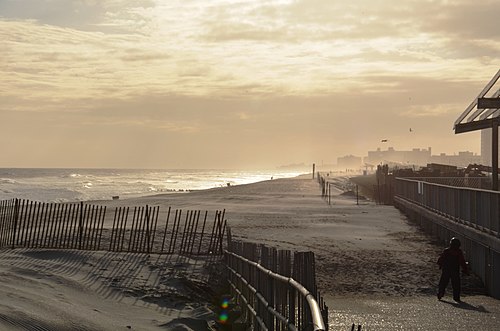 Rockaway Beach in 2013 | |
 | |
| Coordinates: 40°35′10″N 73°48′43″W / 40.586°N 73.812°W | |
| Country | |
| State | |
| City | |
| County/Borough | |
| Community District | Queens 14[1] |
| Population (2010) | |
| • Total | 13,449 |
| Ethnicity | |
| • White | 59.2% |
| • Black | 29.3% |
| • Hispanic | 14.5% |
| • Asian | 2.0% |
| • Other | 5.9% |
| Economics | |
| • Median income | $37,248 |
| Time zone | UTC−5 (EST) |
| • Summer (DST) | UTC−4 (EDT) |
| ZIP Code | 11693 |
| Area codes | 718, 347, 929, and 917 |
Rockaway Beach is a neighborhood on the Rockaway Peninsula in the New York City borough of Queens. The neighborhood is bounded by Arverne to the east and Rockaway Park to the west. It is named for the Rockaway Beach and Boardwalk, which is the largest urban beach in the United States, stretching from Beach 3rd to Beach 153rd Streets on the Atlantic Ocean.[2] The neighborhood, with 13,000 residents as of 2010[update], is also known as the "Irish Riviera" because of its large Irish American population.
History[edit]
Early development[edit]

What is now Rockaway Beach was formerly two different hamlets, Holland and Hammels. In 1857, Michael P. Holland had purchased land and named the area after himself. Soon afterward, Louis Hammel, an immigrant from Germany, bought a tract of land just east of Holland. In 1878, he decided to give portions of his land to the New York, Woodhaven and Rockaway Railroad in order to build a railroad station for the peninsula. The area around it became collectively known as "Hammels". On June 11, 1897, Hammels merged with Holland and they incorporated as the Village of Rockaway Beach.[3] One year later, it was incorporated into the City of Greater New York and became part of the newly formed borough of Queens. However, the neighborhood, along with the eastern communities of Arverne and Far Rockaway, tried to secede from the city several times. In 1915 and 1917, a bill approving the secession passed in the legislature but was vetoed by the mayor at the time, John Purroy Mitchel.[4]

In the early 1900s, the newly built railroad station opened up the community and the rest of the peninsula to a broad range of the population. The wealthy no longer had a monopoly on the peninsula, as various amusement parks, stores, and resort hotels attracted people from all over the city to spend a day or a whole summer there. Much of the area was developed by James S. Remsen and William Wainwright. In this era, it became known as "New York's Playground".
Rockaway's famous amusement park, Rockaways' Playland, was built in 1901 and quickly became a major attraction for people around the region. With its growing popularity, concern over swimming etiquette became a problem and early in 1904, the Captain of the NYPD, Louis Kreuscher, issued rules for those using the beach, censoring the bathing suits to be worn, where photographs could be taken, and specifying that women in bathing suits were not allowed to leave the beachfront.[5]
The park was grand for its time. One of its most popular attractions, the Atom Smasher roller coaster, would be featured in the beginning of This is Cinerama, a pre-IMAX type movie, in 1952.[6] An Olympic-size swimming pool and a million-dollar midway also were built within the amusement park; they would serve the community for over eighty years.[7]
The Temple of Israel Synagogue was built in 1921, and listed on the National Register of Historic Places in 2014.[8]
1930s–1960s[edit]
In the 1930s, Robert Moses came to power as New York City's Parks Commissioner and his extensive road and transportation projects were both a benefit and disaster for the neighborhood. As commissioner, Moses ordered the construction of the Marine Parkway Bridge and the Cross Bay Veterans Memorial Bridge. The bridges were completed in 1937 and 1939 respectively. The Marine Parkway Bridge was built further west on the peninsula between Jacob Riis Park and Breezy Point linking the isolated communities to Brooklyn. The Cross Bay Bridge landed in the middle of the neighborhood of Rockaway Beach.[9]
The new bridge made the community the peninsula's gateway to Queens as it provided the only direct car access to the borough. The construction of the two bridges started to transform the neighborhood and the rest of the peninsula into a more year-round residential area or commuter town, as people had a more convenient way to travel to and from work. The conversion of the Rockaway Beach LIRR branch to the Rockaway subway line also brought an increase to Rockaway's permanent residents.
Although the bridges were intended to improve the Rockaways, Moses' other projects both directly and indirectly hurt the community. One such failed project was the planned construction of the Shore Front Parkway in the 1950s and 1960s. Wanting to connect Staten Island to the Hamptons, Moses focused on making a highway through the Rockaway Peninsula. His idea was to connect the Marine Parkway Bridge with the Atlantic Beach Bridge, which connected the Rockaway Peninsula to Nassau County. The plan would also provide an extension midway through to include the Cross Bay Bridge. Many feared that such an extensive project would do more harm to the peninsula than good and pointed to the community displacement that had happened in the South Bronx because of Moses' roadway construction[10]
Although Moses never got to make his highway, he did leave his mark. A piece of the planned parkway that ran west to east in the Rockaway Park and Rockaway Beach neighborhoods was constructed and opened in 1939. Houses were literally cut in half in order to build the four-lane street. Some of these houses are still standing today. The existing, still unfinished street is locally known as the "road from nowhere to nowhere" because it does not have any relevant connections to any other area or highway.[11]

Robert Moses' construction of other recreational areas and facilities, such as the New York Aquarium and Jones Beach State Park, indirectly impacted the neighborhood as well. These more modern recreational facilities lured tourists and beachgoers away from the peninsula. With fewer customers, businesses and hotels closed, and by the 1950s, the area had fallen into economic decline. The transition from a summer vacationing area to a full-time residential neighborhood had taken its toll.[12]
In an effort to revitalize the neighborhood, the city constructed the Hammel Houses. This social housing project would be one of the many so-called urban renewal efforts that dominated the community and much of its eastern neighbors in the last half of the 20th century. The New York City Housing Authority purchased the land in 1952 on the north side of the elevated track. In 1964, the Authority decided to demolish and rebuild the entire area to what it is today.[12]

In addition to the Hammel Houses, the Dayton Beach Park Cooperative, which, unlike the Hammel Houses, are not projects, was constructed on the south side of the community. The rectangular buildings, all of them thirteen stories high, were placed in close proximity to the shoreline. The building was completed by the end of the 1960s along with the similar looking Surfside Park Apartments and Dayton Towers West in nearby Rockaway Park. The buildings still dominate Rockaway Beach's skyline today, nestled between Rockaway Beach Boulevard to the north and Shore Front Parkway to the south.[13]
The Rockaway Courthouse was built in 1931; it served as a local Municipal and Magistrate's Court and was last used as a civic building in 1962.[14]: 9 It was listed on the National Register of Historic Places in 2014.[8]
Early 21st century[edit]
With more and more people moving to the city, the Rockaways became a destination for day trippers. The area appears in New York magazine's 2007 spring travel issue as a place for "Surfing" and to "scuba dive for sunken ships".[15]
Out-of-towners start to call the beach "Williamsburg on the Rockaways" because some surfers from the Brooklyn neighborhood spend whole summers out in the Rockaways.[16]
The community was devastated by Hurricane Sandy in late 2012. Rockaway Beach reconstruction began with Phase One, a $10 million contract provided by the Army Corps of Engineers to restore 600,000 cubic yards (460,000 m3) of sand along Rockaway Beach in August 2013. The second phase put nearly 3.5 million cubic yards (2,700,000 m3) of sand in 2014 at a cost of about $37 million. Phase Two was paid by the federal government through the Hurricane Sandy relief bill.[17][18]

Demographics[edit]
Based on data from the 2010 United States Census, the population of the combined area of Breezy Point/Belle Harbor/Rockaway Park/Broad Channel was 28,018, an increase of 1,307 (4.9%) from the 26,711 counted in 2000. Covering an area of 2,033.88 acres (823.08 ha), the four neighborhoods had a population density of 13.8 inhabitants per acre (8,800/sq mi).[19]
The racial makeup of the neighborhoods was 78.3% (21,946) White, 7.5% (2,095) African American, 0.1% (29) Native American, 2.1% (595) Asian, 0.0% (8) Pacific Islander, 0.2% (66) from other races, and 0.9% (259) from two or more races. Hispanic or Latino of any race were 10.8% (3,020) of the population.[20]
Rockaway Beach is known as the "Irish Riviera" because of the large Irish American population in the area.[21] The community itself has a total population of more than 13,000 people, making it the third most populated neighborhood on the peninsula.[22] As of the 2000 United States Census, 25.4% of residents in ZIP code 11693 identified themselves as having Irish ancestry, making the Rockaway Beach area the 2nd most Irish region in the whole country—right after Boston, Massachusetts's South Shore, which has roughly 38–40% of its citizens claiming Irish, or mostly Irish, ancestry.[23]
Education[edit]
The neighborhood, like all of New York City, is served by the New York City Department of Education. Rockaway Beach residents are zoned to either P.S. 183, an elementary school,[24] or P.S. 225, a middle school.[25] Additionally, the community contains two private Catholic elementary schools: St. Camillus[26] and St. Rose of Lima.[27]
There is no high school zoning, as all New York City residents who wish to attend a public high school must apply to high schools. Although there is no high school within the community's boundaries, nearby high schools include Beach Channel High School.
Transportation[edit]
The Q22 and Q35 local bus, and the Q53 SBS serves the Rockaway Beach area. The QM16 express bus goes to Manhattan.[28]
The neighborhood's stations are Beach 90th Street and Beach 98th Street, served by the A and S trains.[29] The Q35 goes to the Flatbush Avenue – Brooklyn College subway station (2 and 5 trains) in Midwood, Brooklyn, and the Q53 SBS connects with the 61st Street – Woodside subway station (7 and <7> trains) and the Woodside LIRR station in Woodside.[28] In May 2017, the NYC Ferry initiated service to Rockaway, docking at 108th Street and Beach Channel Drive. This has made the commute into Rockaway more accessible for those who work in Manhattan or want to visit the area from Brooklyn or Manhattan.[30]
Notable people[edit]
- Skip Campbell (1948-2018), Florida legislator and mayor of Coral Springs, Florida born in Rockaway Beach.[31]
- Michael "Iz the Wiz" Martin (1958–2009), one of the most prominent graffiti writers of the early New York graffiti movement.[32]
- Jonathan Monaghan (born 1986), visual artist, born and raised in Rockaway Beach[33]
- Patti Smith (born 1946), punk rocker-poet, wrote about living in Rockaway Beach in her 2015 memoir, M Train.[34]
- Andrew VanWyngarden (born 1983), co-founder of psychedelic rock band MGMT, bought a house in Rockaway Beach in 2012.[35]
- Kenny Vance (born 1943), singer-songwriter and producer.[36]
In popular culture[edit]
- Woody Allen's Radio Days, a 1987 movie highlighting the on goings of a working-class family during the 1930s and '40s, was filmed on location in Rockaway Beach.[37]
- The 2010 documentary film Our Hawaii, by Kryssa Schemmerling, explores the surf culture that sprung up at Rockaway Beach starting in the late 1960s.[38][39]
- Jill Eisenstadt's novels From Rockaway and Swell are set within the world of Rockaway Beach: From Rockaway (1987) within the lifeguard culture during the 1980s and Swell (2017) against the backdrops of the Golden Venture tragedy and the aftermath of 9/11.[40]
- Rockaway Beach is featured prominently in the song Sunscreen by New York artist Matt Booshell
- In a 1973 episode of the TV sitcom All In The Family, Edith Bunker tells daughter Gloria that as a teenager she had been the victim of an attempted date rape while visiting Rockaway Beach.
- In the first episode of the second season of The Marvelous Mrs. Maisel, it is revealed that Susie Meyerson (played by Alex Borstein) was born and raised in The Rockaways, a fact that saves her from being beaten up by a pair of thugs who happen to be from the area too. They say they never meet 'a Rockaway girl' in the city.
- In the Sons of Anarchy, the character Frankie Diamonds is said to have "worked as muscle for the Gambinos down in Rockaway"; according to Clay Morrow.
- In Ramona and Her Father, Ramona Quimby remarks in her thoughts that her older sister, Beezus Quimby, strongly dislikes certain types of clothing, among them her shirt with Rockaway Beach printed on the front.
- "Rockaway Beach" is a 1977 song by the Ramones, from the band's album Rocket to Russia. It was the Ramones' highest-charting single in their career, peaking at number 66 on the Billboard Hot 100.[41]
References[edit]
- ^ "NYC Planning | Community Profiles". communityprofiles.planning.nyc.gov. New York City Department of City Planning. Archived from the original on June 22, 2019. Retrieved April 7, 2018.
- ^ "Chill out this summer ... on an urban beach", The Vancouver Sun, June 2, 2007. "Rockaway Beach is the largest urban beach in the States."
- ^ New York (State). Legislature. Senate (January 1, 1913). Documents of the Senate of the State of New York. p. 9. Retrieved July 24, 2016.
- ^ "The Rockaways". Rootsweb.com. Archived from the original on January 10, 2007. Retrieved December 6, 2006.
- ^ "A Summer Girl Edit". New York Times. May 16, 1904. p. 9.
- ^ "Theme Parks". About.com. Archived from the original on March 19, 2006. Retrieved December 7, 2006.
- ^ "Rockaway...'place of waters bright'". The Wave. Archived from the original on November 27, 2006. Retrieved December 6, 2006.
- ^ a b "National Register of Historic Places Listings". Weekly List of Actions Taken on Properties: 12/09/13 through 12/13/13. National Park Service. February 14, 2014. Archived from the original on September 20, 2019. Retrieved December 31, 2015.
- ^ Cross Bay Veterans Memorial Bridge, Historical Overview Archived August 14, 2022, at the Wayback Machine, NUCRoads.com. Accessed December 6, 2006.
- ^ "An Oceanfront Parkway for the Rockaways". NYCroads.com. Archived from the original on November 13, 2006. Retrieved December 6, 2006.
- ^ "Shore Front Parkway and Its Results". The Wave. Archived from the original on September 28, 2007.
- ^ a b Hammel Playground Archived September 29, 2006, at the Wayback Machine, New York City Department of Parks and Recreation, accessed December 6, 2006.
- ^ "Shore Front Parkway". Emporis. Archived from the original on March 13, 2007. Retrieved December 6, 2006.
- ^ ""Cultural Resource Information System (CRIS)"". New York State Office of Parks, Recreation and Historic Preservation. Archived from the original (Searchable database) on April 4, 2019. Retrieved December 1, 2015. Note: This includes Susan Lawson (n.d.). "National Register of Historic Places Registration Form: Rockaway Courthouse" (PDF). Archived from the original on June 17, 2016. Retrieved December 1, 2015.
- ^ "Spring Travel: Day Trips," New York magazine, April 23, 2007, p.74
- ^ Michael Idov. "Williamsburg in the Rockaways". New York Magazine. Archived from the original on November 8, 2012. Retrieved October 17, 2012.
- ^ "Project adds 600,000 cubic yards of sand to help Rockaway Beach". MyFoxNy. Archived from the original on August 9, 2013. Retrieved August 4, 2013.
- ^ "In Rockaways, Infusion of Sand Will Soon Raise Beaches Hit by a Hurricane". The New York Times. March 1, 2014. Archived from the original on November 12, 2020. Retrieved August 24, 2018.
- ^ Table PL-P5 NTA: Total Population and Persons Per Acre - New York City Neighborhood Tabulation Areas*, 2010 Archived June 10, 2016, at the Wayback Machine, Population Division - New York City Department of City Planning, February 2012. Accessed July 16, 2016.
- ^ Table PL-P3A NTA: Total Population by Mutually Exclusive Race and Hispanic Origin - New York City Neighborhood Tabulation Areas*, 2010 Archived June 10, 2016, at the Wayback Machine, Population Division - New York City Department of City Planning, March 29, 2011. Accessed July 16, 2016.
- ^ "A Shore Thing: Mini guides to five waterfront neighborhoods worth your salt" Archived June 26, 2007, at the Wayback Machine, The Village Voice, May 22, 2006. Accessed June 10, 2007. "There's more to Rockaway Beach than the 1977 Ramones song. A popular beach resort in the 1830s, the 'Irish Riviera' was once a destination for sun worshippers from all over the country."
- ^ "Census Nonsense" Archived July 9, 2012, at the Wayback Machine The Wave, accessed January 27, 2012
- ^ 11693 5-Digit ZCTA - Ancestry Archived February 12, 2020, at archive.today, United States Census Bureau. Accessed December 6, 2006.
- ^ "Welcome - P.S. 183 Dr. Richard R. Green - Q183". New York City Department of Education. July 16, 2016. Archived from the original on July 8, 2016. Retrieved July 16, 2016.
- ^ "P.S. 225 Seaside, Q225, Borough of Queens, Zip Code 11694". New York City Department of Education. Archived from the original on August 16, 2016. Retrieved July 16, 2016.
- ^ "St. Camillus Catholic Academy -Rockaways and Broad Channel Queens". St. Camillus Catholic Academy. May 11, 2016. Archived from the original on August 20, 2016. Retrieved July 16, 2016.
- ^ "Rockaway Beach, Queens". St. Rose of Lima Catholic Academy. July 13, 2016. Archived from the original on September 18, 2016. Retrieved July 16, 2016.
- ^ a b "Queens Bus Map" (PDF). Metropolitan Transportation Authority. August 2022. Retrieved September 29, 2022.
- ^ "Subway Map" (PDF). Metropolitan Transportation Authority. September 2021. Retrieved September 17, 2021.
- ^ McGeehan, Patrick. "To Rockaways Residents, New Ferry Service Is a Promise Kept" Archived May 7, 2021, at the Wayback Machine, The New York Times, May 1, 2017. Accessed May 6, 2021.
- ^ "Walter 'Skip' Campbell, Broward mayor and former state senator, dies at 69". Tampa Bay Times. October 24, 2018. Archived from the original on January 5, 2020. Retrieved September 18, 2019.
- ^ "Today in Hip-Hop History: The Source Remembers Graf Legend Iz the Wiz on His Birthday - the Source". November 10, 2020.
- ^ "An Interview with Jonathan Monaghan". saic.edu. October 10, 2014. Archived from the original on July 27, 2021. Retrieved July 27, 2021.
- ^ Green, Penelope. "Patti Smith, Survivor; In her new memoir, M Train, the punk elder makes peace with her ghosts and finds solace in a century-old bungalow in the Rockaways." Archived September 13, 2018, at the Wayback Machine, The New York Times, October 3, 2015. Accessed September 13, 2018. "Patti Smith, the musician and author, in the yard of her home in Rockaway Beach, Queens."
- ^ Rockaways Hipsterfication Report: MGMT Buys A House, Beer Garden Looms Archived February 27, 2015, at the Wayback Machine, Gothamist. Retrieved October 16, 2012.
- ^ Rearick, Kristie. "Kenny Vance and the Planotones keep fans happy with stop in Pitman" Archived July 14, 2018, at the Wayback Machine, South Jersey Times, May 17, 2013. Accessed September 13, 2018. "A resident of Rockaway Beach in Queens for 38 years, a visit from Hurricane Sandy last October completely destroyed his home."
- ^ "IMDB: Radio Days". IMDb. Archived from the original on August 30, 2017. Retrieved June 28, 2018.
- ^ "New York Foundation for the Arts". nyfa.org. Archived from the original on August 20, 2015. Retrieved June 3, 2015.
- ^ "Our Hawaii (Video 2010)". IMDb. Archived from the original on January 7, 2016. Retrieved June 3, 2015.
- ^ Giff, Patricia Reilly (1999). Lily's Crossing: Patricia Reilly Giff: 9780440414537: Amazon.com: Books. ISBN 0440414539.
- ^ Randazzo, Ryan. "New York Series: The Ramones ‘Rockaway Beach’", NYSMusic, April 5, 2018. Accessed September 6, 2023. "When The Ramones wrote their highest charting single (peaking at number 66 on the Billboard Hot 100) 'Rockaway Beach,' it was an attempt to write a surf rock song in the same light as 'Surfin' USA' or 'I Get Around,' but the heavy rockers couldn’t seem to do anything without their signature grit."
External links[edit]
Definitions from Wiktionary
Media from Commons
News from Wikinews
Quotations from Wikiquote
Texts from Wikisource
Textbooks from Wikibooks
Resources from Wikiversity
| External images | |
|---|---|
- The Wave: local Rockaway newspaper since 1893
- 100th Precinct
- Forgotten New York: Rockaway Beach
- The Rockaway Times

| National | |
|---|---|
| Geographic | |