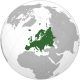
ملف:Mali (orthographic projection).svg

حجم معاينة PNG لذلك الملف ذي الامتداد SVG: 550 × 550 بكسل. الأبعاد الأخرى: 240 × 240 بكسل | 480 × 480 بكسل | 768 × 768 بكسل | 1٬024 × 1٬024 بكسل | 2٬048 × 2٬048 بكسل.
الملف الأصلي (ملف SVG، أبعاده 550 × 550 بكسل، حجم الملف: 83 كيلوبايت)
| هذا ملف من ويكيميديا كومنز. معلومات من صفحة وصفه مبينة في الأسفل. كومنز مستودع ملفات ميديا ذو رخصة حرة. |
je besoin de kate
ملخص
| الوصف |
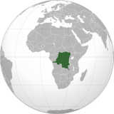
English: Mali (orthographic projection)
Português: Mali (projeção ortográfica)
Español: Mali (proyección ortográfica) |
||
| التاريخ | |||
| المصدر | عمل شخصي | ||
| المؤلف | Marcos Elias de Oliveira Júnior | ||
| الترخيص (إعادة استخدام هذا الملف) |
|
||
| إصدارات أخرى |
|


| Orthographic projections maps created by Ssolbergj |
|---|
| Orthographic projections maps created by Ssolbergj: |
تاريخ الملف
اضغط على زمن/تاريخ لرؤية الملف كما بدا في هذا الزمن.
| زمن/تاريخ | صورة مصغرة | الأبعاد | مستخدم | تعليق | |
|---|---|---|---|---|---|
| حالي | 22:04، 18 يوليو 2022 | 550 × 550 (83 كيلوبايت) | M.Bitton | added the missing border between Ethiopia and Eritrea, per request | |
| 21:40، 12 سبتمبر 2012 | 550 × 550 (108 كيلوبايت) | Palosirkka | Scrubbed with http://codedread.com/scour/ | ||
| 11:59، 19 يوليو 2012 | 550 × 550 (284 كيلوبايت) | Chipmunkdavis | http://www.france24.com/en/20120712-al-qaeda-linked-islamists-drive-malis-tuaregs-last-stronghold-ansogo-timbuktu-mnla-ansar-dine-mujao MNLA fully removed, Asar Dine does not claim independence. Azawad no longer exists as a state. | ||
| 01:19، 2 يوليو 2012 | 550 × 550 (236 كيلوبايت) | Chipmunkdavis | MNLA still claims they control everything outside the three major towns, [http://www.timeslive.co.za/africa/2012/06/30/islamists-destroy-mali-world-heritage-sites]. Discussion ongoing at en:Talk:List of States with Limited Recognition | ||
| 17:18، 30 يونيو 2012 | 550 × 550 (284 كيلوبايت) | Aotearoa | Reverted to version as of 22:34, 12 June 2012, Independent Azawad is not existed at the moment (territory under administration of anti-independent Ansar Dine | ||
| 21:26، 13 يونيو 2012 | 550 × 550 (236 كيلوبايت) | Chipmunkdavis | Reverted to version as of 14:18, 12 June 2012 Unexplained revert against talk consensus | ||
| 22:34، 12 يونيو 2012 | 550 × 550 (284 كيلوبايت) | Boudoul | Reverted to version as of 13:30, 12 June 2012 | ||
| 22:34، 12 يونيو 2012 | 550 × 550 (284 كيلوبايت) | Boudoul | Reverted to version as of 13:30, 12 June 2012 | ||
| 14:18، 12 يونيو 2012 | 550 × 550 (236 كيلوبايت) | Chipmunkdavis | For most of the countries to which it applies, it is used. See talk page for further discussion. | ||
| 13:30، 12 يونيو 2012 | 550 × 550 (284 كيلوبايت) | Boudoul | Outside of central government control will be true for so many countries - that's a ridiculous reason. | ||
| 13:30، 12 يونيو 2012 | 550 × 550 (284 كيلوبايت) | Boudoul | Outside of central government control will be true for so many countries - that's a ridiculous reason. | ||
| 18:54، 10 يونيو 2012 | 550 × 550 (236 كيلوبايت) | Chipmunkdavis | Rv unexplained change against talkpage discussion consensus. Standard dark/light green shading across globe maps. | ||
| 03:19، 10 يونيو 2012 | 550 × 550 (284 كيلوبايت) | Aantandou | Reverted to version as of 14:59, 9 June 2012 | ||
| 16:19، 9 يونيو 2012 | 550 × 550 (236 كيلوبايت) | Phoenix B 1of3 | Reverted to version as of 14:47, 8 June 2012 Revert Sock Puppet | ||
| 14:59، 9 يونيو 2012 | 550 × 550 (284 كيلوبايت) | Aantandou | Reverted to version as of 11:26, 8 June 2012 | ||
| 14:47، 8 يونيو 2012 | 550 × 550 (236 كيلوبايت) | Chipmunkdavis | Reverted to version as of 13:02, 28 May 2012 Unexplained reversion | ||
| 11:26، 8 يونيو 2012 | 550 × 550 (284 كيلوبايت) | Boudoul | Reverted to version as of 12:37, 28 May 2012 | ||
| 13:02، 28 مايو 2012 | 550 × 550 (236 كيلوبايت) | Chipmunkdavis | Correct borders, presentation of both de jure and de facto control | ||
| 12:37، 28 مايو 2012 | 550 × 550 (284 كيلوبايت) | Straore01 | Reverted to version as of 15:23, 12 April 2012 | ||
| 12:36، 28 مايو 2012 | 550 × 550 (284 كيلوبايت) | Straore01 | Reverted to version as of 18:34, 19 April 2012 | ||
| 18:37، 29 أبريل 2012 | 550 × 550 (236 كيلوبايت) | Chipmunkdavis | Somalia shouldn't be the exception, but neither is it a compelling precedent, especially compared to all the precedents in the other direction I've noted. There is no criteria that has been used for Somalia, so there's nothing to apply here. | ||
| 17:43، 28 أبريل 2012 | 550 × 550 (284 كيلوبايت) | GeoMauri | If both Azawad as Somaliland is not recognized by any country, why Somalia is the exception? Why not use the same criteria for Mali? | ||
| 19:22، 24 أبريل 2012 | 550 × 550 (236 كيلوبايت) | Chipmunkdavis | The light green shade is used in many maps, China, India, Georgia, Moldova, Serbia. Somalia is the exception. | ||
| 18:34، 19 أبريل 2012 | 550 × 550 (284 كيلوبايت) | GeoMauri | Not have the same approach with the map of Somalia and Somaliland | ||
| 04:44، 17 أبريل 2012 | 550 × 550 (236 كيلوبايت) | Chipmunkdavis | Area now held for a period of time. Map reflects standard of uncontrolled territories. Borders | ||
| 15:23، 12 أبريل 2012 | 550 × 550 (284 كيلوبايت) | Mysterie~commonswiki | Not enough information provided for why light green is used. First idea that comes into reader's mind that is these areas are divided. | ||
| 15:01، 12 أبريل 2012 | 550 × 550 (284 كيلوبايت) | Mysterie~commonswiki | Reverted to version as of 13:08, 11 April 2012 - Not enough information provided for why light green is used. First idea that comes into reader's mind that is these areas are divided. | ||
| 14:57، 12 أبريل 2012 | 550 × 550 (284 كيلوبايت) | Mysterie~commonswiki | Not enough information provided for why light green is used. First idea that comes into reader's mind that is these areas are divided. | ||
| 04:34، 12 أبريل 2012 | 550 × 550 (236 كيلوبايت) | Phoenix B 1of3 | Azawad is a disputed territory, disputed lands go in light green, doing so does not question the de jure status of mali, but rather makes note of there current lack of control over the region | ||
| 02:51، 12 أبريل 2012 | 550 × 550 (284 كيلوبايت) | Mysterie~commonswiki | Reverted to version as of 13:08, 11 April 2012 | ||
| 19:28، 11 أبريل 2012 | 550 × 550 (236 كيلوبايت) | Chipmunkdavis | The map does show the entire Mali. It's standard to show uncontrolled territories in a lighter green shade. There's also no reason to remove the borders separating for example Eritrea and Ethiopia | ||
| 13:08، 11 أبريل 2012 | 550 × 550 (284 كيلوبايت) | Francish7 | Reverted to version as of 08:09, 20 September 2011 | ||
| 13:07، 11 أبريل 2012 | 550 × 550 (285 كيلوبايت) | Francish7 | Reverted to version as of 01:02, 7 April 2012 | ||
| 09:12، 11 أبريل 2012 | 550 × 550 (285 كيلوبايت) | Francish7 | Reverted to version as of 01:02, 7 April 2012 this is a map of Mali in its entirety | ||
| 16:59، 10 أبريل 2012 | 550 × 550 (236 كيلوبايت) | Phoenix B 1of3 | Reverted to version as of 16:53, 7 April 2012 see talk page | ||
| 21:13، 7 أبريل 2012 | 550 × 550 (284 كيلوبايت) | Geni | Reverted to version as of 11:35, 7 April 2012 rv see talk | ||
| 16:53، 7 أبريل 2012 | 550 × 550 (236 كيلوبايت) | Phoenix B 1of3 | defacto means it is in existance | ||
| 11:35، 7 أبريل 2012 | 550 × 550 (284 كيلوبايت) | Geni | bit early to include Azawad here. give it a week or so | ||
| 04:37، 7 أبريل 2012 | 550 × 550 (236 كيلوبايت) | Chipmunkdavis | Fixing borders of Yemen, Ethiopia, etc. | ||
| 03:43، 7 أبريل 2012 | 550 × 550 (285 كيلوبايت) | Chipmunkdavis | Shift border | ||
| 01:02، 7 أبريل 2012 | 550 × 550 (285 كيلوبايت) | Phoenix B 1of3 | Azawad is defacto independent and should be shown as disputed | ||
| 12:32، 6 أبريل 2012 | 550 × 550 (284 كيلوبايت) | Francish7 | Reverted to version as of 08:09, 20 September 2011 the sovereign state has not changed | ||
| 11:12، 6 أبريل 2012 | 550 × 550 (285 كيلوبايت) | Chipmunkdavis | Light Green Azawad | ||
| 08:09، 20 سبتمبر 2011 | 550 × 550 (284 كيلوبايت) | Banhtrung1 | Added the South Sudan. | ||
| 21:14، 17 يونيو 2011 | 550 × 550 (283 كيلوبايت) | Marquinhos | {{Information |Description ={{en|1=Mali (orthographic projection)}} {{pt|1=Mali (projeção ortográfica)}} {{es|1=Mali (proyección ortográfica)}} |Source ={{own}} |Author =[[User:Marcos Elias de Oliveira Júnior|Marcos Elias de Olive |
استخدام الملف
أكثر من 100 صفحة تستخدم هذا الملف. القائمة التالية تعرض فقط أول 100 صفحة تستخدم هذا الملف. قائمة كاملة متوفرة.
- العلاقات الأرجنتينية المالية
- العلاقات الأردنية المالية
- العلاقات الأسترالية المالية
- العلاقات الأفغانية المالية
- العلاقات الألبانية المالية
- العلاقات الألمانية المالية
- العلاقات الأمريكية المالية
- العلاقات الأندورية المالية
- العلاقات الأنغولية المالية
- العلاقات الإثيوبية المالية
- العلاقات الإريترية المالية
- العلاقات الإستونية المالية
- العلاقات الإسرائيلية المالية
- العلاقات الإماراتية المالية
- العلاقات الإيرانية المالية
- العلاقات الإيطالية المالية
- العلاقات البالاوية المالية
- العلاقات الباهاماسية المالية
- العلاقات البرازيلية المالية
- العلاقات البريطانية المالية
- العلاقات البلجيكية المالية
- العلاقات البنمية المالية
- العلاقات البنينية المالية
- العلاقات البوتانية المالية
- العلاقات البولندية المالية
- العلاقات البوليفية المالية
- العلاقات البيلاروسية المالية
- العلاقات التشيكية المالية
- العلاقات التونسية المالية
- العلاقات الجورجية المالية
- العلاقات الدنماركية المالية
- العلاقات الدومينيكانية المالية
- العلاقات الروسية المالية
- العلاقات الرومانية المالية
- العلاقات الزامبية المالية
- العلاقات الزيمبابوية المالية
- العلاقات الساموية المالية
- العلاقات السريلانكية المالية
- العلاقات السعودية المالية
- العلاقات السلوفينية المالية
- العلاقات السودانية المالية
- العلاقات السورية المالية
- العلاقات السورينامية المالية
- العلاقات السويسرية المالية
- العلاقات السيراليونية المالية
- العلاقات الطاجيكستانية المالية
- العلاقات العراقية المالية
- العلاقات العمانية المالية
- العلاقات الغابونية المالية
- العلاقات الغامبية المالية
- العلاقات الغرينادية المالية
- العلاقات الفانواتية المالية
- العلاقات الفيجية المالية
- العلاقات القبرصية المالية
- العلاقات الكازاخستانية المالية
- العلاقات الكندية المالية
- العلاقات الكوبية المالية
- العلاقات الكورية الجنوبية المالية
- العلاقات الكورية الشمالية المالية
- العلاقات الكوستاريكية المالية
- العلاقات الكولومبية المالية
- العلاقات الكونغوية المالية
- العلاقات الكويتية المالية
- العلاقات الكيريباتية المالية
- العلاقات الكينية المالية
- العلاقات اللاتفية المالية
- العلاقات اللاوسية المالية
- العلاقات اللبنانية المالية
- العلاقات اللوكسمبورغية المالية
- العلاقات الليبية المالية
- العلاقات الليبيرية المالية
- العلاقات الليتوانية المالية
- العلاقات الليختنشتانية المالية
- العلاقات الليسوتوية المالية
- العلاقات المارشالية المالية
- العلاقات المالاوية المالية
- العلاقات المالطية المالية
- العلاقات المالية الماليزية
- العلاقات المالية المدغشقرية
- العلاقات المالية المصرية
- العلاقات المالية المنغولية
- العلاقات المالية الموريشيوسية
- العلاقات المالية الموزمبيقية
- العلاقات المالية المولدوفية
- العلاقات المالية الميانمارية
- العلاقات المالية الميكرونيسية
- العلاقات المالية الناميبية
- العلاقات المالية الناوروية
- العلاقات المالية النيبالية
- العلاقات المالية النيجيرية
- العلاقات المالية النيكاراغوية
- العلاقات المالية النيوزيلندية
- العلاقات المالية الهايتية
- العلاقات المالية الهندوراسية
- العلاقات المجرية المالية
- العلاقات المكسيكية المالية
- العلاقات الهندية المالية
- العلاقات الوسط إفريقية المالية
- العلاقات اليابانية المالية
- العلاقات اليمنية المالية
عرض المزيد من الوصلات إلى هذا الملف.
الاستخدام العالمي للملف
الويكيات الأخرى التالية تستخدم هذا الملف:
- الاستخدام في ace.wikipedia.org
- الاستخدام في ami.wikipedia.org
- الاستخدام في ang.wikipedia.org
- الاستخدام في arz.wikipedia.org
- الاستخدام في ast.wikipedia.org
- الاستخدام في avk.wikipedia.org
- الاستخدام في av.wikipedia.org
- الاستخدام في azb.wikipedia.org
- الاستخدام في az.wikipedia.org
- الاستخدام في az.wiktionary.org
- الاستخدام في ban.wikipedia.org
- الاستخدام في ba.wikipedia.org
- الاستخدام في bcl.wikipedia.org
- الاستخدام في be.wikipedia.org
- الاستخدام في bew.wikipedia.org
- الاستخدام في bg.wikipedia.org
- الاستخدام في bh.wikipedia.org
- الاستخدام في bi.wikipedia.org
- الاستخدام في bn.wikipedia.org
- الاستخدام في ca.wikipedia.org
- الاستخدام في cdo.wikipedia.org
- الاستخدام في ce.wikipedia.org
- الاستخدام في cs.wikipedia.org
- الاستخدام في de.wikivoyage.org
- الاستخدام في diq.wikipedia.org
- الاستخدام في dty.wikipedia.org
- الاستخدام في el.wikipedia.org
- الاستخدام في en.wikipedia.org
- Mali
- History of Mali
- LGBT rights in Mali
- List of companies of Mali
- Talk:Mali/Archive 1
- European Union Capacity Building Mission in Mali
- List of senators of French West Africa
- Wikipedia:Wikipedia Signpost/2019-11-29/On the bright side
- Wikipedia:Wikipedia Signpost/Single/2019-11-29
- List of terrorist attacks in Mali
- User:AlbanianEditor1990/sandbox
- الاستخدام في en.wikinews.org
- Category:Mali
- Wikinews:Template messages/Infoboxes/Countries
- Template:Mali
- Al-Qaida demands hostage exchange; threatens to kill if demands not met
- At least fifteen dead after stampede at Mali mosque
- Al-Qaeda commander Abou Zeid killed in Mali by French forces
- Chadian army: Mokhtar Belmokhtar 'killed' in Mali
- Five dead after bar attack in Bamako, Mali
- Template:Infobox/lookup/Mali
- الاستخدام في es.wikipedia.org
اعرض المزيد من الاستخدام العام لهذا الملف.